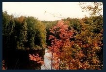
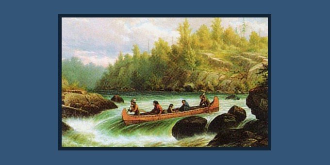
 “The river Called. The call is the thundering rumble of distant rapids, the intimate roar of white water…a primeval summons to primordial values”
 Missinaibi River: Mattice to Moosonee (1980)
(Chapter Two)
Our waitress fought back a chuckle as I ordered breakfast with my mangled high school French. “Deux ouefs au lard et pain grillé pour petit dejuner.…..Oh, et un TRES GRAND café s’il vous plait“. Brian, did I order bacon or lard??? With an understanding smile she pushed her pencil back into her hair and disappeared behind the counter.
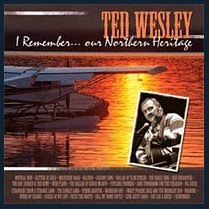
Looking around the roadside diner, it was obvious that Brian and I were the first customers of the day. Truckers had yet to arrive as their big rigs, heavily laden with logs, raced by the storefront window. Lost in the scenario before me, Lightfoot’s tune ‘Cabaret’ pushed aside his song ‘On The High Seas’ which I had been humming all morning.
“Sitting in a roadside diner,
the big trucks rolling by
I don't seem to know at times what's best
And still I'd like to tell her
That I miss her so, in North Ontario”
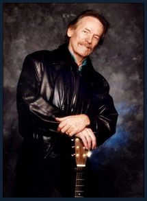
Did I share some parallel universe with Gordon Lightfoot? Hours earlier Gord’s ‘on-time trains’ had derailed my sleep in
Hornepayne and now I was sitting in a roadside diner off Hwy 11 as big trucks rolled by this northern Ontario town of Mattice. How spooky was that? Gord’s lyrics had mirrored my life on more than one occasion.
 Mattice
, situated at the junction of the
Missinaibi River and Trans-Canada Highway is typical of these small northern towns. It’s predominantly French speaking population had dwindled in recent years due to a faltering economy. Those trucks piled high with logs were finding ever fewer pulp and paper mills, the region‘s principle employer, still in operation. Founded in 1910, the town’s growth was spurred on by the arrival of the Canadian Transcontinental Railway. Earlier still, the Missinaibi had served as an important fur trading route joining the Great Lakes to James Bay. It was the desire to retrace part of this historic route that had drawn us to this sleepy town.
Coffees drained, our waitress directed Brian to a payphone where he fed it a coin and dialled the number provided by Ontario’s
Ministry Of Natural Resources office. It was our understanding that the town elder on the other end acted as a liaison for river voyagers. As in some covert spy mission, the word “Missinaibi” would be uttered, setting into motion a series of actions to literally bring us “in from the cold“,…. at least for the night.

Mr. Benoit‘s
(1) age was not betrayed by his gait as he hurriedly approached with an extended hand and broad grin. “Bonjour mes amis”. Without a breath, the undecipherable slurry of French continued to pour from his craggy face and had us nodding yes or no wherever it seemed appropriate. A pause……….then an eruption of laughter as he slapped his knee in response to some joke only he was party to. Brushing past us he unlocked the door to the rather dilapidated Quonset hut and directed us into the darkness. A flick of a switch bathed the aging arena in light as Mr. Benoit ran about pointing and muttering. Cuisine (kitchen), chambre a coucher (sleeping facilities), salle de bain (washroom). With yet another belly-laugh and a slap on the back, he pressed the keys into the palm of my hand and departed as quickly as he had arrived. Brian and I stared at each other in silence. What had just happened? A jovial French-Canadian had just entrusted two total strangers to the unsupervised use of the town’s arena.

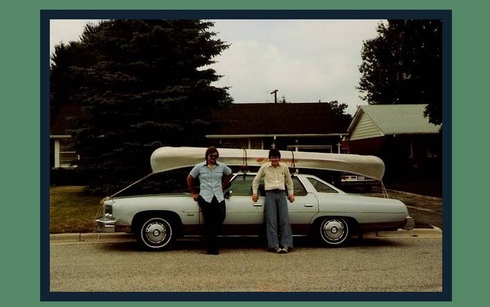
With our gear safely stowed inside we hopped in my Chevy and headed east. Those stake trucks heavily laden with logs continued to bounce down the highway, at one point criss-crossing the
Mattagami River(2) where to our amazement the river was so jam-packed with a log drive that one could literally walk from shore to shore without setting foot in water. Imagine the shock in having planned a canoe trip on the Mattagami only to arrive to the scene before us. A two hundred mile portage down the center of the river perhaps?! Further east was our destination of Cochrane Ontario. Parking our car at the Ontario Northland Railway station, we headed across Railway Street for last minute provisions and more importantly, to the Cochrane Tavern for one last glass of ale. Catching the ONR bus back to Mattice we hoped we would find ourselves back at this terminal in some twelve days time.

The bus rattled along the shoulder and came to a dusty halt just short the Missinaibi River bridge. Hopping off we strolled along the river bank debating our plan of action. The running waters seductively murmured, as from the lips of some dark and mysterious mistress, tempting us to forgo the comforts of “our” Quonset hut and sleep beside her this night. Seduced we retrieved our gear, ferried our faithful Starcraft
(3) to the bank and tucked the keys behind the hydro meter as instructed.

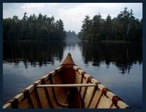
With a two week supply of provisions and gear straining the canoe’s thwarts, I steadied myself on the gunwales and began to add my own weight to that of the cargo. With my left foot planted soundly on the canoe floor I followed my departure ritual, purposely dragging my right boot through the flowing waters. Feeling the coolness wick its way up my sock, I knew I had been anointed by river and that we were no longer strangers. Pushing off into the evening light I savoured that first stroke of the paddle. After summertime dreams and many a winter’s night of preparation, we were finally on our way.
I don’t recall quite how I came to know of the
Missinaibi River. The name itself seemed to dance in my mouth when first spoken. Increasingly, I found myself repeating it with growing excitement and anticipation. In the early 1980’s there wasn’t a great source of information to draw upon in regards to these mysterious northern rivers. Browsing through the card catalogues at
The University Of Western Ontario, I could only find some highly specific government hydrological surveys and the occasional article in outdoor magazines. A freshly mimeographed
(4) copy of the route description arrived by mail that winter which I supplemented with eleven dusty 1:50,000 scale topographical maps obtained from the bowels of a local book store. The personal computer was in it’s infancy in 1980 and digital age tools such as the Internet and
Google Earth were yet to be developed. Today, contemporary voyagers can network with veteran paddlers or zoom in from the cosmos to study a particular rapid prior to departure - all from armchair comfort. Yet, the ability to examine a river from source to mouth by satellite somehow seems to diminish the adventure from the days when we left home with nothing more than a
Tupperware container of top-maps, scribbled notes and a mental image of what may lay ahead.
Google had no idea of what lurked around that next bend in the river, nor did we…

Water spouts danced in the wind before us, like miniature tornadoes, they performed pirouettes teasing us to give chase. With evening’s advancing darkness came lower temperatures and soon our amazement was diverted from these dying ‘water devils’ to heaven’s multitude of sparkling stars suspended in the clearest sky I had ever witnessed. A late camp was set on the first available point while steaks sizzled on the grill. With our best ‘Mr. Benoit accent‘, we rattled off orders to each while packing gear and inching ever closer to our sleeping bags.

Morning broke under an unsettled steel-blue horizon leaving us uncertain if the first drenching would be courtesy of the skies or the river. Our first real encounter with whitewater was to be Rock Island Rapids where the obvious portage was not on either bank but rather over the island itself. In short order we were back in the canoe where I smiled in satisfaction as the river remained between it’s banks and wasn’t dripping from my pant pockets.
Black Feather rapids soon followed. A checkerboard of strewn rocks challenged us to a game in which the odds of staying afloat favoured the river. Brian and I declined the rumbling dare and chose to line
(5) the loaded canoe along the eastern bank. Having secured ‘painters’
(6) to both bow and stern we planted each rocky step carefully, playing the canoe out into the swiftly flowing current. With lines taut, Brian and I appeared to dance a riverside ‘pas de deux’. An un-choreographed ballet consisting of pirouettes and pliés - leaps from rock to rock while lines snapped and swirled as we danced the canoe through a boulder strewn stage. My smug satisfaction in having remained dry ended abruptly as I suddenly found myself looking up from the Missinaibi, now running at chin level. Having played out too much line, the Missinaibi was quick to remind me of who was boss. Grabbing the stern with one violent yank, the current flung me into the rapids which mockingly roared as I backstroked to shore. As water drained from the camera dangling from my neck, the sickening realization swept over me that I had lost more than my dignity on that plunge.
(7) The final rock garden in this series was Beam Rapids which we humbly portaged muttering Burton Cummings’ tune ‘Fine State Of Affairs‘ under our breaths - with heavy emphasis on the title.
"Ooh I miss the real exciters
Anything with anyone
Such a fine thing, fine state of affairs... ooh yeah
Lining up for fast one-nighters
When the final show was done
Such a fine thing, fine state of affairs
No one cares, no, no"
The afternoon sun had finally found the courage to punch through the cloud cover and began to drive the dampness from our clothes. It’s orange rays danced in the treetops, descending to meet us at our evening’s campsite. Pulling to shore at Kettle Falls, we set up camp, prepared supper and studied the geological formations known as “kettles” for which the falls was named. Bathed in sharp shadows, I made my way to the edge of the falls where I surrendered to my fatigue and soon was absorbed by the beauty before me. Mesmerized, I drifted into a deep and intense reflection of my life - a unique emotional experience which stays with me to this day.
(Kettle Falls - Missinaibi River A Fleeting Glimpse Of Spirituality - Chapter Three)
A sunny dawn greeted us once again as we pushed on down the river. Several runable rapids lifted our spirits and made for an enjoyable morning. Passing Alice Island on our left we set a steady pace for what would be the geological highlight of the voyage. The landscape transforms dramatically at Thunderhouse Falls where the metamorphic Precambrian rock of the Canadian Shield delivers the Missinaibi to the sedimentary base of the Hudson Bay Lowlands. There too the foliage changes from the dense boreal forest to a ground cover generally made up of sparse tamarack and black spruce struggling to grow in the thin soil along the well drained river banks.

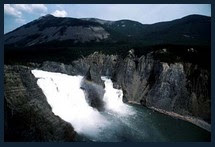
For Brian and I, Thunderhouse had taken on an air of mystery and intrigue. What little was written about the falls painted it in an eerie, almost supernatural light. Native-Americans roamed these woods centuries before and had themselves marvelled at this cataract. The river drops approximately 30 meters (90 ft) over three closely spaced cascades where aerated water froths and boils in it’s thunderous decent to the chasm below. So violent an action that the vibrating roar is transmitted through one’s bones as much as it is deafening to the ear. At the end of the canyon stands a pyramid shaped rock which juts defiantly from the swirling waters. Indian lore had preserved the legend that this rock, known as Conjuring or Conjurer’s House, was a sacred stone tee-pee and the roar came from the spirits of their forefathers held eternally captive within. A site to explore with respect and to hold in reverence.

Paddles momentarily hung in the air as our ears strained to hear the first tell-tale sounds of Thunderhouse Falls. Sketchy route descriptions had us bordering on paranoia as we scouted the west bank for a portage marker. The current gained strength as the width of the river narrowed and with each stroke the rumble intensified. Rumours of panic stricken canoeists, paddles desperately reaching for salvation as they were swept over the falls abound but could never be substantiated. Regardless, the falls were not to be trifled with if one didn’t wish to join the captive spirits shouting for eternity within Conjuror’s House below. Partially obscured by foliage, the yellow portage marker flashed it’s warning and had us scramble for shore.

The humid air was almost as thick as the swarms of mosquitoes that eagerly greeted us. Squinting from the glare, I nudged Brian, drawing his attention to a mother duck and three ducklings caught in the headwaters of the falls. Like sports fans at the big game, Brian and I shouted words of encouragement to the hapless feathered family as their webbed feet paddled furiously against the current. Drawn almost to the precipice they slowly gained headway, finally reaching a quiet eddy where the exhausted mom took stock of her flock. Brian and I gave a victory shout and pumped our fists into the air, as if our encouragement intervened in the inevitable. Further ashore sat a twisted and perforated aluminum canoe - another sobering reminder of the unforgiving strength of the Missinaibi.

The mile long portage around the falls was reasonably well travelled, rising and falling with the landscape. Essential packs were ferried to a clearing capable of accommodating several tents. With camp erected, we leisurely hiked back and forth along the trail relaying our gear along the way while taking frequent side excursions to view the gorge. Words fail to capture the beauty and grandeur of this magnificent landscape capable of titillating each of the senses. Sparkling granite rusts and ever-greens framed by azure skies and cerulean waters. Pungent pines mingling with the heady fragrance of ferns anchored by an aromatic earthen base. The rhythmic drumming of a ruffled grouse’s wings or the white throated sparrow’s lilting melody set against gurgling waters. The gentle caress of a wafting breeze or the searing sting of pelting rain, all for the exhilarating taste of victory savoured at the end of a rapid run. Not surprisingly this seductive splendour has captured the hearts and minds of artists over the years, serving as muse to several of
Canada’s Group Of Seven(8).


A pleasant afternoon was spent exploring the falls from various vantage points, photographing the cataract under playful noon time rays to evening’s falling shadows. Retreating to base camp we prepared supper under descending darkness. Time yet for a few hot chocolates around the fire before we would climb into our sleeping bags and be lulled to sleep by the muffled roar of the falls.


Striking camp we made our way to the portage terminus where our canoe and gear lay in wait. Repacking under a light drizzle, we set off across the foaming river making for the opposite shore. Ahead of us was a foreboding rocky outcrop we nicknamed “the monkey house” which would serve as camp on a future trip. Periodically glancing over my shoulder I watched Conjurer’s Rock recede into the misty horizon - it’s exploration would have to wait for a subsequent trip as well. Our attention was soon diverted to the rumble of Stone Rapids which we ran, avoiding the 875m (0.5 mile) portage on the eastern bank.


The next imperative would be the 2350m (1.5 mile) portage around Hell’s Gate Canyon. Drizzle had turned to a gentle downpour, making the water sing as we put to shore at the head of the gorge. The day was still young - far to early to make camp and wait out the inclement weather. Tying tin cups and pots to our backpacks we set off clanging along the trail in hopes of warning any bear of our approach. Spring rains had muddied our path and fallen deadwood frequently blocked our way as we stumbled along in this mosquito haven. Straining under the weight of our packs, our feet would often become mired in the sucking muck below. Boots sank until they disappeared beneath the ooze, then reappeared with the next strained step, slurping to the surface as the vacuum released.
"Pussywillows, cat-tails, soft winds and roses
Rainpools in the woodland, water to my knees
Shivering, quivering, the warm breath of spring
Pussywillows, cat-tails, soft winds and roses"
Dropping our packs for a breather, we would hike off the trail to peer over the precipice and marvel at Hell‘s Gate canyon below. How easy it would be to miss that narrow veiled path weaving through the undergrowth and find oneself lost in these dense woods. With the rain washing perspiration from our brows, we finally stumbled into a clearing which we named “the Ranger Camp” for it was here that the government had at one time tested the site for it’s suitability in being dammed for hydroelectric power. Holes drilled into the granite canyon wall were all that bore witness to that endeavour. Thankfully the Missinaibi continues it’s unharnessed run to the bay to this day.

In all we would traverse each portage three times as first we ferried personal backpacks, then camp packs containing cooking utensils, tent and other wilderness essentials and finally the canoe itself. Portaging the canoe became a feat of endurance. The muddy trail had now been churned up by our previous trips and stuck to our boots like glue. With the canoe raised overhead, we stumbled over deadfall and slid in the mire. The bow frequently became entangled in dangling branches sending it in a direction opposite to our own while rewarding us with a shower of rain. Neither of us were smokers, yet we lit up a couple of pungent stogies in order to blow acrid cigar smoke at the mosquitoes feasting on our outstretched arms. The famished hoards, unfazed by repellent and blown smoke more frequently required a swat to be driven off. Releasing my grip on one gunwale brought the canoe down on my head with a metallic clang that resonated through the forest. Cursing under my breath, I swear I could hear distant wildlife laughing at my plight! Yet I wouldn’t trade that experience for a lounge chair and umbrella drink at some posh Caribbean resort.
 "Are We Having Fun Yet?"
Morning remained overcast as we completed the final leg of the portage. Slip-sliding down the steep clay incline, my momentum carried me into the refreshing waters of Bell’s Bay where the previous day‘s sweat and grime rinsed away. The next few hours were some of the most thrilling as we rode one bucking rapid after another descending from the shield through the clay belt to the lowlands. Our pace began to slow once the river widened, spending the rest of the afternoon in an almost hypnotic rhythmic paddle while entertained by dragon flies feasting on our entourage of mosquitoes.

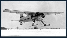
We pitched camp on a sandy bank at Bull Moose Bay, a deeper and wider expanse of river than we has previously encountered. One of the few locations on the Missinaibi assailable by float plane. A nearby creek gurgled as it’s runoff joined the Missinaibi. It’s waters ran clear however we dare not replenish our canteens in fear of catching a bout of the dreaded
'Beaver Fever'(9). Brian, standing by the gurgling stream with the coffee pot in hand, was staring at his feet and shaking his head in dejected disbelief. The running shoes that had served him so well along those muddy trails had finally decomposed or more accurately exploded. Caked in mud, the sole had separated from the uppers revealing a grungy sock full of toes wiggling within. In sombre ceremony, Brian changed to his boots and spoke few heartfelt words of praise and remembrance of said pair. Hoisting tin mugs of scotch overhead in a final salute the service concluded with the cremation of the canvas runners on our pyre.
Dawn couldn’t arrive soon enough as a new blight known as “no-see-ums” had discovered us. A scourge so tiny that they were all but invisible as they eased their way through the mosquito netting to inflict a burning bite. Even the reeking stink held between our nylon walls didn’t discourage their aggression. Brian and I looked at each other with wrinkled noses, silently incriminating each other for the eye watering stench emanating from the heap of filthy clothes piled between us. Why, those shorts could be hoisted on the end of a stick and used as skunk repellent! Undeniably laundry day had arrived!

Casting off we made for the mouth of the Soweska River, certain a good campsite would be found near the confluence. With a relaxed paddle ahead of us, we discussed what should be done with the plastic bag of festering clothing stowed between the thwarts. In a moment of inspiration we pulled to shore and retrieved a rigid plastic milk crate that carried our kitchen gear. Emptying the perforated box, we placed our clothing within and filled each pocket with a squirt of dishwashing detergent. Securing the open top with bungee cords, we tied the stern painter to the box and headed out to mid river. Tossing our improvised washing machine overboard we leisurely paddled downstream towing the crate behind us. As the box bounced off of the occasional river rock, the agitation scrubbed our duds clean. When soap bubbles no longer burst from our laundry, we knew the rinse cycle was complete and we could haul the crate back aboard. Spreading our damp denims over the center thwarts, the sun provided the dry cycle. River clean, wind dry and sunshine fresh….if only I could figure out how to market this wilderness laundromat.

Weather in the north seemed to change hourly. Once again under overcast skies, we searched for our next campsite. A metallic glint caught Brian’s attention and naturally it begged exploration. Slightly removed from the riverbank stood a government water monitoring station. Finding the door to the small corrugated metal hut unlocked we peered inside. In one corner stood some apparatus replete with wires, pipes, gauges and meters. Powered by batteries charged by rooftop solar panels, the mechanism would spring to life momentarily, then once again go dormant until the next reading. The true find were the bunks inside as we knew immediately that this would be home for the night. No mosquitoes, horseflies, black flies or no-see-ums! Such a pleasant accommodation that we lazed about for a second night, drying out, repacking and cleaning up both ourselves and our host cabin. Grateful for this wilderness oasis, we left it in better shape than in which it had been found.
A blustery day followed with the wind continuously buffeting us. Securing an upright paddle to the center thwart, we lashed a sturdy spruce pole across the blade. Draping that frame with a tarp we created a sail with which we could harness the wind and speed our journey.

“I'm sailing down the summer wind
I got whiskers on my chin
And I like the mood I'm in
As I while away the time of day
In the lee of Christian Island”
Not exactly the sleek sailboat which Gord sang about but with a bit of trim our canoe rode the waves magnificently.

Alternating glances between our top-map and the hazy horizon began to increase in anticipation of our next landmark. In the distance, the silhouette of Portage Island rose from the merging waters of the Missinaibi and Mattagami rivers - the combined flow giving birth to the mighty Moose River. Invigorated by our progress, we decided to push onwards for a few hours more. Finally, with the afternoon light fading, we pulled for a beautiful sand spit on the western shore. Surveying our campsite, it was difficult to believe we were so far north in Ontario. As these caramel sands bound forest greenery to sparkling turquoise waters, the location was deceptively reminiscent of some Caribbean resort. Not such a long stretch of the imagination as our route was punctuated by numerous fossils along the way. Preserved in the sedimentary rock were palm fronds and trilobites, inhabitants of a tropical north millennia before.

If sand was a condiment, my rehydrated supper would have been well seasoned. Finding the gritty mess unpalatable I scratched out a hole and returned it to the very beach that had so generously contributed to our meal. Riverside, I sat back on my heels and washed my utensils, chuckling over the antics of a large demented bumble bee which derived pleasure in delivering repeated stings to my backpack.
….And so it was on this summer’s eve that I drifted into a state of rare contentment for at this moment all was right with my world. Far removed from societies hectic pace, my tension and anxiety dissipated. Deadlines were dictated by the setting sun, line-ups meant walking in tandem on a portage trail, my noisy neighbour was an industrious woodpecker and nature’s rapids would be the only traffic jam encountered. There were no bills, no commercial breaks or intrusive phone calls. Far from my house yet so much more at home here where all I really needed could be carried on my back.

Glancing downstream, I wondered what adventures tomorrow would bring as we continued our voyage down the mighty Moose River on it’s perpetual journey to the bay…
(Missinaibi River - First Excursion - Moose River 1980 - Chapter Four - Conclusion)
“Rivers have what man most respects and longs for in his own life and thought--a capacity for renewal and replenishment, continual energy, creativity, cleansing”
--John M. Kauffman
 (1)
(1) Mr. Benoit - the character was real but his name changed as my detailed notes were placed somewhere safe, never to be seen again in this lifetime…
(2) Mattagami River - See photo of log jam in post entitled
‘Miscellaneous Photos Of Various River Trips’(3) Starcraft - a manufacturer of aluminum canoes amongst other products.
(4) Mimeograph - think of it as a pre-computer hardcopy.
(5) “Line” - the act of lining is were the canoe is guided through a set of rapids from the river bank by means of it’s painters (see #6).
(6) Painters - the term refers to the ropes tied to both the bow and stern of a canoe.
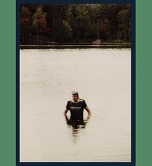
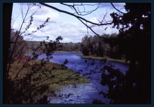
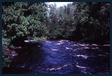
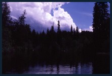
(7) As my 35mm Yashica camera became waterlogged early in the trip - the later photos are from my 1982 trip with a second canoe.
(8) Group of Seven - a group of Canadian artists of varying styles who captured Canadian landscapes on canvas early in the 1900’s
(9) Beaver Fever - a slang term for an infectious diarrhoea cause by ingestion of the parasite
Giardia lamblia which can live symbiotically in the Canadian beaver. Smaller streams dammed by the beaver may have a greater amoeba or cyst load than the river itself.
Google Earth Co-ordinates:(cut and paste everything after the dash- (
in red) into Google Earth search bar.
Mattice Ontario - Missinaibi Jump-Off Location
Lat/Long
49° 36’56.15” N, 83° 15’48.37” WKettle Falls
Lat/Long-
49° 47’11.44” N, 83° 13’13.62” WThunderHouse Falls
Lat/Long-
50° 03’09.80” N, 83° 11’05.33” WMoose River & Abitibi River Junction
Lat/Long-
51° 03’09.28” N, 80° 55’53.89” WMoosonee ON
Lat/Long-
51° 51’16.28” N, 80° 38’43.81” W© Copyright - All rights reserved.
____________________________________________________
____________________________________________________
Slide Show of the 1982 Lower Missinaibi River Trip
(1982 Trip With 2nd Canoe to Moose River Crossing)
(See Albany River Slideshow for Scenes Of Moosonee)
“The rivers flow not past, but through us, thrilling, tingling, vibrating every fibre and cell of the substance of our bodies, making them glide and sing” -- John Muir
 “In nature there are neither rewards nor punishments - there are consequences”
 “In nature there are neither rewards nor punishments - there are consequences”
 (1) Chapter One - Hornepayne Ontario On Route To the Missinaibi River (1980)