
Kamiskotia & Mattagami Rivers
(Kenogaming Lake To Timmins Ontario)
July 8 - 13, 1985
"Wherever there is a channel for water, there is a road for the canoe."
Henry David Thoreau

(Numbers in blue throughout text refer to rapids/logjams found on map at end of post)
The road ahead shimmered as mid-day heat radiated skyward above Hwy 101’s sticky asphalt surface. A hint of acrid smoke rode the wind rushing through half opened windows, yet the gusts offered little relief from this summer’s stifling temperature. Another sweep of the dial recaptured the same lone radio station crackling with country crooners, punctuated periodically by sketchy updates on local forest fires.
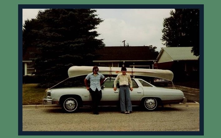
Such was the blistering July afternoon as Brian and I cruised towards the town of Timmins (1) in search of the regional Ministry of Natural Resources office. Fearing our Kamiskotia River trip might be in jeopardy, it was our hope that the Ministry would provide the definitive word on the extent of local forest fires. A note taped to the glass door, itself curling under the sun’s relentless assault, simply stated that all open campfires were banned until further notice. All those months of planning hadn’t prepared us for the uncertainty of fire restrictions, let alone having flames scorch our backsides in a furious downstream paddle.
The motel office clerk, a pleasant gal, cheerfully chatted away as she booked our room for the night. Further negotiations secured her services for the morning’s shuttle of my chevy from our Kenogaming Lake jump-off point back to Timmins, where we hoped to find ourselves in a week’s time. On entering our unit, we drew the curtains and collapsed on our beds as the air conditioner shuddered and convulsed in it’s futile struggle to cool our darkened room. Heat lightning began to split the sky as the accompanying thunder rivalled the pounding in my head. Lacking energy to root through a trunk full of meticulously packed gear for our first aid kit, Brian and I headed across the parking lot to the local supermarket for some last minute provisions….. and aspirin.
I awoke long enough to turn off the flickering drone of the television’s test pattern…
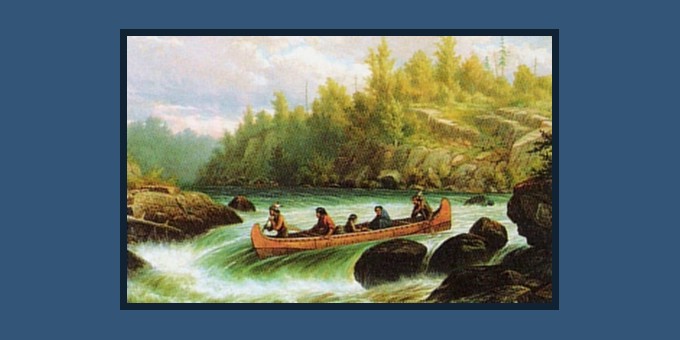
The Kamiskotia River route we had chosen had been used for millennia by nomadic Ojibwa & Cree Indians to access their bountiful hunting and trapping grounds. Later, voyagers established inland trading posts at Mattagami, Kenogamissi and Frederick House to better feed Europe’s insatiable appetite for fur. The discovery of gold in 1903 near the town of Porcupine replaced trappers with prospectors & surveyors as they travelled the Kamiskotia in search of fortune. By the late 1940’s, forest access roads began to reach the Kamiskotia river in order to harvest virgin timber for the demands of the local mining needs and as a result, portages fell into disrepair. The Ministry Of Natural Resources claimed to have reopened the portages to facilitate recreational canoeists, however, we were to question this assertion numerous times along our journey.
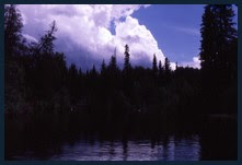
Thankfully, overnight rains had brought some relief to the stifling temperatures and tinder dry forests. Arriving at Kenogaming Lake, we found it sparkling like a jewel with it’s sapphire waters clasp in the verdigris green & copper setting of the shoreline. Eager to depart, gear was quickly transferred from trunk to canoe and with one last check we bade our chauffeur goodbye, then watched as the horizon devoured my chevy‘s taillights. Now only the lapping waters of the lake and the shrill call of the cicadas broke the silence.

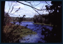
The early portion of the Kamiskotia River route (32km/20mi) consisted primarily of a series of narrow lakes - Kenogaming, Akweskwa, Misty, Beaucage and Opishing Lakes each joined by rapids over which an occasional logging bridge spans the narrows. A leisurely paddle on our first day had us traverse the picturesque Kenogaming Lake and portage our first set of rapids (#1&2) where the current delivered us to Akweskwa Lake. A rocky outcrop about 8km (5mi) along Akweskwa Lake’s eastern bank appeared to offer a promising campsite.
 No more picture perfect camp could be found as we stood high above the lake and surveyed the magnificent panorama. As testament to the site’s popularity, a pole frame stood lashed together with hemp cord on which a tarpaulin could be added for quick shelter. Overnight rains and our barren granite campsite emboldened us to risk a small cooking fire.
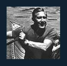
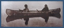
 Yuri & Brian at Akweskwa Lake Camp
 Had not the river called, I could have lazed about on this site for the duration of my vacation.
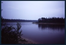
Another stellar morning had us reach the end of Akweskwa Lake where it mirrored Kenogaming of the previous day. The lake narrows under a logging bridge where the next two rapids (#3&4) frame the diminutive Misty Lake. Beaucage Lake followed as we approached the bridge over Hwy 101. Below the highway could be heard the muffled roar of Opishing Falls which offered portages along either bank (#5).
 Approach to Opishing Falls Below Hwy 101
 Opishing Falls Below Hwy 101
A carry along the eastern bank circumvented the falls where we re-launched the Grumman on Opishing Lake. Opishing might be considered nothing more than a widening of the Kamiskotia River with a single constriction dividing it’s twelve mile length. Evening found us midway up the second expanse of where we once again pitched camp on the eastern shore.
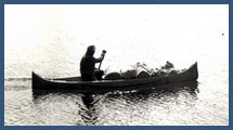
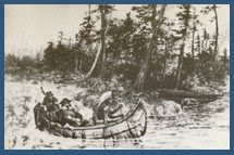
 Brian Relaunching Grumman Canoe Below Opishing Falls
 Our third morning on the Kamiskotia delivered us to the northern end Opishing Lake where a final narrowing forms the Kamiskotia River proper. With the constriction came the next series of rapids (#6,7 & 8) where maps indicated portages along the eastern bank. Scouting the rapids (#8) from shore, they appeared less formidable than the Ministry’s portage as no unobstructed path through the dense bush could be found. The rapids were run with relative ease in spite of the shallowness at the foot of the descent. As we were to find out, from this point on, the government’s description of the Kamiskotia route was frequently inaccurate, not so much through lack of effort but rather by the continuously changing nature of the river itself.

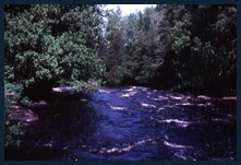
Water levels on the lake portion of this route remain relatively stable throughout the seasons. In contrast, the narrow river runs swiftly with the spring runoff yet the rapids may deliver but a trickle during late July and August. As a consequence, the remains of old harvested logs and deadfall alike could be swept along the river, continuously redistributed with each passing season. The result was a river experience as we had never before encountered.
This particularly dry season, a few of Kamiskotia’s rapids were so depleted of water that they resembled damp gravel beds, punctuated by exposed ledges and jutting rocks. Whether lining or running, the aluminum would frequently protest with a unnerving grating sound as the hull stuck to the riverbed as would a porcupine’s quill to a hound’s nose. Jagged boulders which could open our aluminum hull like some wilderness can opener frequently offered their invitation along route.

The other curse of the Kamiskotia were the numerous log jams encountered (#17 & onwards). Passage was frequently blocked by large slimy logs scattered about from one bank to the other as if God had left some colossal game of pick-up sticks mid tournament. Buoyant, bobbing slippery logs, ready to offer a break or fracture to the first misplaced step. Uprooted stumps with interwoven sticks and projecting poles became nature’s own ‘cheval de frise’(2) waiting to impale those who stumbled on the rollers underfoot.
 Typical of the Many Log Jams Encountered On The Kamiskotia
(This is the center of the river looking downstream!)
 Nature's Own 'Cheval De Frise'(2)
 Unknowingly we had come unprepared, as logger’s pike poles & peaveys (3) would have been as useful as our paddles. Where the river was impassable, our only other option was to portage the obstruction.
 The late, great Canadian canoeist Bill Mason once quipped “Anyone who says they like portaging is either a liar or crazy”. I believe Bill may have even included those picturesque woodland trails running along side some babbling brook, where shafts of sunlight dance on a carpet of leaves, illuminating the path underfoot. Where chirping songbirds alight on your shoulder and join in harmony as you whistle some lilting melody. Where racoons & chipmunks sit amongst the dew covered wildflowers while Bambi watches your canoe & packs float effortlessly between maples and pines.
 In stark contrast, we were to find that many of the Ministry’s portages were so overgrown that the intended path was often difficult to discern. Had anyone been down this route since the 1940’s? Scouting the tree-tops, sometimes a slight dip in the foliage would betray where a trail once lead. On more than one occasion we had no choice but to blaze a new trail through dense scrub brush, brambles, thatches and sapling trees. The Grumman would first be shoved into the vegetation after which Brian and I would step into the canoe and crawl from stern to bow. Our combined weight pushed the canoe downwards through the suspending growth, displacing it to either side. Backing out, the canoe would once again be pushed forward another few feet and the process repeated until navigable water was reached.
 Intimate Kamiskotia River Corridor
 Portaging was such a genteel term. We determined that our tough slogging was more akin to ‘cross country furniture moving’…
Yet other portages had been reasonably well maintained, probably through the efforts of local fishermen who would access select portions of the route via the logging roads. Anglers were drawn to the pools below rapids (#6 & onwards) and the log jams (#17 & onwards) where brook trout find cover. The Ministry of Natural Resource’s policy was to leave these jams intact precisely for the habitat they provide. Northern pike & pickerel were said to be abundant along this entire route.

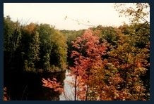
The narrowness of the Kamiskotia river corridor offered a more intimate journey than rivers such as the mile wide Albany or Moose. Here one felt cradled by the forests which often extended right up to the riverbanks. Trees failed to be trimmed away by massive springtime ice flows as on large northern rivers. Sweepers (4) frequently draped the river, ready to ‘clothesline’ the inattentive canoeist, or at least rearrange their hairdo. The meandering course allowed a stealthy approach with which to catch wildlife unaware while rounding the next bend. Moose were frequently sighted along this stretch of river (#6 to 13), watching us with bored curiosity as they munched riverside reeds & rushes. Without doubt, the picturesque beauty of the Kamiskotia made up for all challenges it offered along route.
 Moose Cow Behind Rock On Kamiskotia River
  Hampered by the portages, we had covered a mere 20km (12mi) as the Kamiskotia now made a short easterly jog. Rapids at this curve in the river (#14,15 & 16) were run as once again the portages were in a sad state of repair. A few kilometres onward the topography bends the Kamiskotia into a hairpin turn as it resumes it’s northerly flow. We erected camp near where an old logging road (5) spans the river. I don’t recall any odorous incidents, yet my notes I referred to this location as ‘skunk camp’. I do however remember encountering a juvenile black bear ambling across the foggy gravel roadway as we prepared to shove off the following morning. The two of us paused momentarily exchanging dumbfounded stares before going about our businesses.
 Brian On Old Logging Road Crossing the Kamiskotia River
 Yuri On Old Logging Road Near 'Skunk Camp'
 Kamiskotia’s northern flow along it’s narrow corridor continued to be hindered by frequent rapids and log jams (#17 - 23). Unwilling to unpack and risk damage to my camera along the trail, I now regret that the number of photographs documenting this trip appeared to be inversely proportional to the number of obstacles encountered. Once a difficult portage was completed, there was little desire to retrace our steps simply to document our completed endeavour.
 As the river turned east, we found both the setting sun and our final log jam (#23) at our backs. Although our top map indicated a logging bridge spanning the river a short distance downstream (0.5km/0.3mi), we failed to see it. As such a landmark would be hard to miss, perhaps it was washed away and later rebuilt for it is clearly visible these days on Google Earth. The meandering Kamiskotia once again takes a hairpin turn, swinging south before an abrupt turn to the north. The next set of rapids (#24) were found to be runnable as well as circumvented by a decent east bank portage. With the sun now skimming the treetops, we made camp midway along the trail where we nursed our wounds. Brian had developed an abscessed tooth which added misery to wet blistered feet, aching joints, skinned shins, sore backs, calloused hands and sun burns. Without regret, we were truly aching head to toe.
Day four had the river turn east once more where in quick succession it passed under a hydro line and another logging bridge before it’s waters are joined by Enid Creek entering from the north. The scenic Kamiskota riverscape continued as it’s flow made a gradual and final bend to the southeast. Remaining rapids were run or lined with ease (#25 -30) in a lively paddle towards Kamiskotia Falls, our final challenge prior to entering the Mattagami River another mile (1.6km) further downstream.

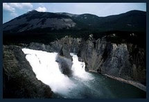
The roar of Kamiskotia Falls could be heard in the distance, it’s crescendo reverberating upstream along the riverbanks. Spray rising above the approach rapids offered a final warning of imminent danger. Landing on a rock island we surveyed the waterfall as we plotted our route around this picturesque obstacle. The cataract was to the left (north) while a former channel to the right of our island was now a dry ledge offering a route to shore. With a short break to grab a snack and marvel at the cascading waters, we re-launched the Grumman in the swirling pool at the base of our ledge to the immediate right of the falls. (6)
 Yuri At Kamiskotia Falls
Brian At Kamiskotia Falls
With sadness I bade goodbye to our Kamiskotia home of the last five days. Bow pointed southward, we entered Mattagami’s sluggish current and began our upstream paddle. Here the Mattagami’s characteristics were reminiscent of it’s sister rivers, the Abitibi and Missinaibi in their northerly flow from the Canadian Shield to the Hudson Bay lowlands in search of James Bay. Brian At Sandy Falls Hydroelectric Generating Station - Mattagami River
 Our final day brought us ever closer to civilization as riverside homes and cottages became more frequent. The drone of air traffic betrayed the location of Timmins airport somewhere off to the east. Further along, periodic whines and buzzes escaped from the lumber mill outbuildings nestled along the eastern shoreline. Saws & planers filled bins & silos with sawdust & shavings as the aroma of freshly milled lumber wafted on the warm afternoon breeze. Stepping ashore for the final time we hauled the Grumman up the riverbank trimming Timmins waterfront park. As Brian went off to retrieve our car stowed at the motel, I tried to acclimatize myself to the sounds of traffic, of children at play on the ball diamond and the chatter of picnickers on this glorious day. Propped up with my back against the overturned canoe, I drifted off in thought, still rolling to motion of the river though on solid ground.
A blare from my chevy’s horn startled me from my daydreams and with that insult yet another river trip became consigned to memory…
 (1) Timmins - A northern Ontario city (Pop. ~43,000) which until recently had the distinction of being the largest Canadian municipality in land mass. Timmins most recent claim to fame was as the childhood home of country artist Shania Twain.
 (2) Cheval de frise - a defensive device used through medieval times to the U.S. Civil war and beyond. Variations of a central beam with sharpened poles protruding at right angles, which could impale advancing aggressors.
 (3) Pike Poles & Peaveys - Poles with hooks used by loggers to handle harvested logs on river drives.
 (4) Sweepers - tree branches growing or fallen so as to jut out over the river from shore capable of ‘sweeping‘ an inattentive paddler out of his canoe or at least rearranging his hairdo.
(5) This old logging road spanned the river with a rudimentary log bridge. Google Earth now shows the road dressed with fresh gravel and a Google Earth photo appears to show a much improved bridge (named Montcalm Bridge) at this location if the contributor’s photo is correctly placed.
(6) Google Earth image of Kamiskotia Falls outlining our route in the exceptionally dry summer of 1985. In this image the dry ledge to the right (south) of the island no longer appears above water and may not offer a portage route off the island. (see Below)

 Map of Kamiskotia - Mattagami River Route
(Click on Map to Enlarge Image)
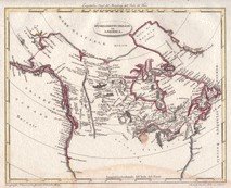
 Ontario Roadmap Location of Kamiskotia River
_______________________________________
_____________________________________
Slide Show of My 1985 Trip On Kamiskotia & Mattagami Rivers
© Copyright - All rights reserved.Google Earth Co-ordinates:
(cut and paste everything after the dash- (in red) into Google Earth search bar.)
Kenogaming Lake Jump-off - 48° 4'13.81"N, 81°53'16.51"W
Kamiskotia River - Opishing Falls At Hwy 101 48°14'21.54"N, 81°50'47.56"W
Kamiskotia River - Camp #3 "Skunk Camp" 48°28'53.75"N, 81°45'57.82"W
Kamiskotia Falls On Kamiskotia River - 48°34'7.62"N, 81°32'7.33"W
Kamiskotia-Mattagami Rivers Junction - 48°34'11.25"N, 81°30'39.02"W
Mattagami River - Camp #5 - Upstream of Sandy Falls Hydro Dam - 48°30'29.80"N, 81°27'12.25"W
Mattagami River Take-Out At Timmins Park - 48°28'34.98"N, 81°21'6.60"W


No comments:
Post a Comment