
Thames River, London Ontario & Beyond
Rambling Reflections On A Lifetime Love Affair With Water
Part One
Part One

"You know you are a canoeist when you can't go over a bridge without looking for water under it."
Anonymous
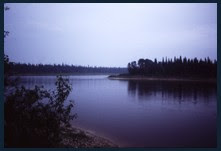
 The staccato percussion of ice pellets drumming on my windowpane was all it took to sabotage my studies. Staring beyond my reflection as it stared back, I scanned the frigid blue riverscape which lay just outside my bedroom window. My mirrored image seemingly mocked me as it floated freely upon the Thames River, while I remained captive by textbooks & exams till spring thaw. How I yearned to be free on the river,…any river.
 Bedroom View of Thames River London Ontario near Riverside Dr. & Wharncliffe Rd.
My first glimpse of the London’s Thames River was likely in the fall of 1973 during orientation at The University of Western Ontario(1). University Bridge, like any other, could not be crossed without peering in wonderment at water flowing below.
 University Of Western Ontario Campus
 With further exploration it became evident that the Thames was integral to London’s cityscape as it’s meandering course stitched it’s way repeatedly through the fabric of town. No major land route could escape crossing the river at least once regardless of the direction travelled. Nor was it lost upon me that London’s forefathers had engaged in geographic plagiarism as numerous place names were borrowed from this city’s British namesake. London was also known as ‘The Forest City’ as many streets were draped with old growth trees often forming picturesque green canopies over laneways and boulevards. Charmed, I was soon to fall in love with London, the U.W.O. campus and of course the Thames. Never far from the river, I took full advantage of waterfront parks and trails to unwind from my academic pressures.
 The Thames River - London Ontario Canada
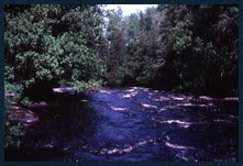
 Thames River Below Fanshawe Lake Conservation Area Dam
 Thames River, London Ontario At Springbank Park
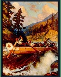
 Stepping away from Springbank Park’s groomed riverside trail one winter, I trudged through knee-high snow to the river’s edge for a better view. Suddenly aware of a rather panicked voice some distance behind me, I turned. There on the path stood a craggy old myopic gentleman waving his cane at me. “ You’d better tell your mother where you are, son”. Chuckling, I thanked him for his concern, however as I was now reaching my mid-twenties, I felt no urgent need to place a long-distance call to mom with an explanation of my whereabouts. In a few years time I was to find myself canoeing the Albany River, chasing ice floes on their way to James Bay .
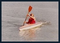
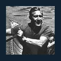
I had met Brian, my canoeing partner, during my sophomore year at university. Somewhere in our conversations, a common love of the outdoors was realized. It wasn’t long before we formed a partnership and began exploring Ontario’s rivers, but that you already know from a previous post entitled ‘Sharing Opposite Ends Of A Canoe’.
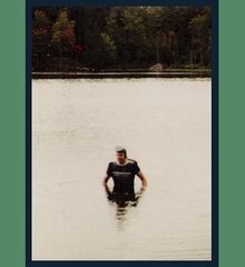
During my final year at university, I was delighted to be offered the ground floor of a vacant church house rectory for very modest rent. To show my appreciation, I took it upon myself to shovel the snow from the walks and driveway so that the church choir could practice in the basement. One particularly blustery winter day I was ready to concede defeat to the blizzard when I noticed a pickup truck drive by, reverse, then enter my laneway. Lowering his plough blade, the driver cleared out the entire parking lot with just a few passes. I was momentarily confused as the cab window rolled down and the cheerful driver shouted out “there you go Father!” Having noticed the black T-shirt under my coat, the helpful driver had mistaken me for
 a priest. Chuckling as I watched him pulled away, I waved back and heard myself shout out “bless you my son”. Every storm thereafter I was sure to wear my black T-shirt in hopes of a repeat performance. (2)
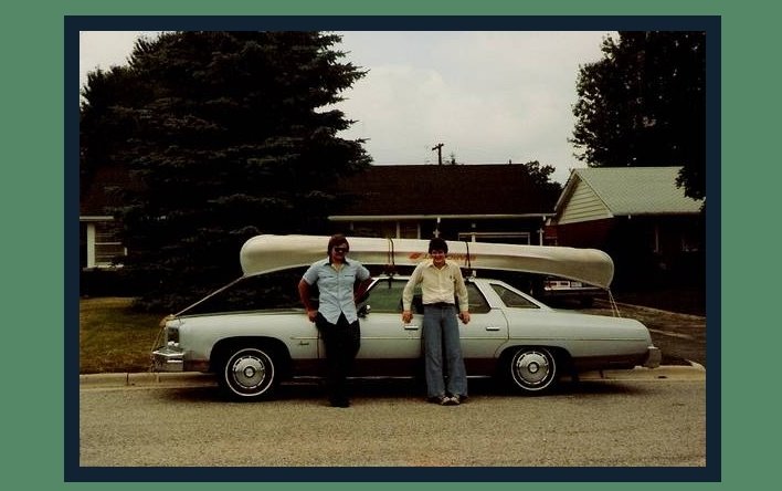
 Church House in Background with my 1976 Chev Impala In Drive
 Map Room In Church House
(Planning the Next Trip)
 Then there came that first spring day when the promise of change was undeniable. Bright, blinding sunlight melting dangling daggers of ice, drop….. by hesitant drop. Discoloured remnants of roadside snow banks, themselves melting into miniature rivers in search of the Thames via some nearby drainage grate. An uncommitted springtime breeze, continuously fluctuating between warm and cool in an attempt to make up it‘s blustery mind. The ever-present sound of gurgling water, swelling streams with icy runoff. Each element was yet another invitation to brush the snow from the canoe still lashed to the car’s roof and wet the paddles for the first time this season.
 No doubt eager to rid herself of two restless babbling urban adventurers, Brian’s girlfriend Nancy offered to pack a sac lunch, then chauffeur the two of us beyond city limits in search of a suitable jump-off site. As much of the Thames flows through privately owned farmland, we were judicious as to where we would put in so as not to anger salivating guard dogs, amorous bulls or gun toting farmers.
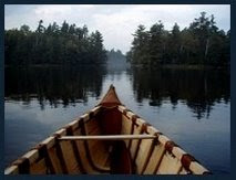
In our eagerness, I swear we could push our canoe over the riverbank’s muddy ledge, chase after it with leaps and bounds, then hop aboard in one continuous motion even before fully buoyant on the water. Afloat for the first time this new year, it wasn’t long before stiff joints, soft hands and a tender tush offered reminders of past winter’s stagnation. Free of schedules, we were content to pull a few leisurely paddle strokes then lean back with eyes closed and smile at the sun, all the while drifting aimlessly on the current. The refreshing breeze carried upon it the earthy aroma of muddy banks still veined with rivulets in their own tortuous quest for the river. Songbirds twittered from once naked tree limbs, now sporting a vibrant green coat of buds. Winter had finally relinquished its hold on this new spring and we had seized the first opportunity offered.
 Thames River
 Thames River
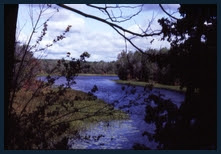
  With afternoon sunlight receding, we put to shore at what ever town lay next ahead. Even in Canada, townsfolk don’t often see two muddy river warriors portaging a canoe along city streets, hull raised overhead, patiently waiting for the traffic light to turn green. Dividing upstream pedestrian traffic flow with our overturned bow, we went in search of a phone booth in order to recall our chauffeur. Cellular phones were still a few years away and their practicality would not be realized for yet another decade. Bulky and limited in range, the first cell phone was nicknamed “the brick” for obvious reasons. So massive they could be considered ballast and at best might require a separate portage trip or at worst, swamp a canoe. Had one been available, I would have left this ‘brick’ at home or perhaps, still humming their tunes, offered it to Pink Floyd - “all in all, it’s just another brick in the wall…”
…and with that phone call our excursion came to an end. At home that night, I reflected on this under-appreciated river which flowed through my back yard. The Thames had been a witness to history. It offered recreational pursuits to those who wished to explore it’s waters and riverside parks. It drained the fertile farmlands of south-western Ontario and fed the ever dwindling northern Carolinian forests along it’s banks. Daily, townsfolk, lost in thought battled traffic along side it’s banks while students criss-crossed campus in a frenzied race to class, oblivious to the Thames as it continued it’s perpetual 273 km (170 mi) journey west to Lake St. Clair.
The Thames River was designated a Canadian Heritage River in 2000.
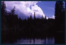
 London Ontario Nightscape
The Maitland River
(Ball's Bridge to Benmiller Ontario)
Celebration of spring’s rebirth could never be confined to tripping the waters of one lone river. The Maitland River offered an alternative daytrip for our season opening shakedown cruise.
 Londesboro Road At Maitland River Jump-off
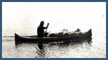
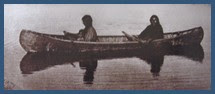
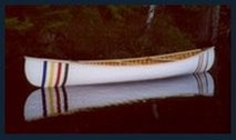
 Brian & 15' Starcraft Canoe At Ball's BridgeDrab Spring Day on Maitland River
A short drive west of London, we would deposit one vehicle at the community of Benmiller, then continue along Londesboro Road with the other car to where Ball’s Bridge spans the waterway. Shimmying down the grassy embankment below the bridge, Brian & I would throw a daypack into the canoe set ourselves adrift. A gentle afternoon paddle along the Maitland helped to get our ‘sea legs’ back, while hoisting a few ‘cold ones’ along route attempted to sabotage that same endeavour.
 Ball's Bridge - Maitland River
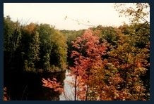
 Drab Spring Day On Maitland River From Ball's Bridge
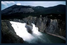
 The Maitland shares many characteristics with the Thames River to the south and the Saugeen to the north. Draining the farmlands of south-western Ontario, the Maitland meanders through fertile valleys and meadows as it makes it’s way westward to Lake Huron. Although canoeable between the towns of Wingham and Goderich, our chosen section was an abbreviated elbow east of Benmiller. Flowing between elevated gravel banks and earthen cliffs, red-tail hawks patiently circled, hovering on thermals while in search of their next meal. Maples, birches, ash, poplar, cedars and spruces frequently framed the picturesque shoreline. Pulling out at the community of Benmiller, we peered downstream and debated extending our trip a few kilometres further to where the town of Goderich overlooked the river‘s mouth. Shallower below town, the flow picks up speed and offers an exhilarating ride to the lake, particularly with springtime run-off. A raised ledge spanning the river just below the rather remote yet luxurious Benmiller Inn & Spa presented itself as the only visible obstacle. Not wishing to engage in another car shuffle, we lashed the canoe to Brian’s roof and headed home to London where textbooks, classes & exams waited to greet us.
 Ledge On Maitland River Below Benmiller Ontario
 (1) Photo of UWO Campus somewhat as it appeared when I attended in the 1970’s. Note University bridge crossing the Thames in the foreground. (Below)
 Londesboro Road At Maitland River Jump-off
 Brian & 15' Starcraft Canoe At Ball's BridgeDrab Spring Day on Maitland River
 Ball's Bridge - Maitland River
 Drab Spring Day On Maitland River From Ball's Bridge
  The Maitland shares many characteristics with the Thames River to the south and the Saugeen to the north. Draining the farmlands of south-western Ontario, the Maitland meanders through fertile valleys and meadows as it makes it’s way westward to Lake Huron. Although canoeable between the towns of Wingham and Goderich, our chosen section was an abbreviated elbow east of Benmiller. Flowing between elevated gravel banks and earthen cliffs, red-tail hawks patiently circled, hovering on thermals while in search of their next meal. Maples, birches, ash, poplar, cedars and spruces frequently framed the picturesque shoreline. Pulling out at the community of Benmiller, we peered downstream and debated extending our trip a few kilometres further to where the town of Goderich overlooked the river‘s mouth. Shallower below town, the flow picks up speed and offers an exhilarating ride to the lake, particularly with springtime run-off. A raised ledge spanning the river just below the rather remote yet luxurious Benmiller Inn & Spa presented itself as the only visible obstacle. Not wishing to engage in another car shuffle, we lashed the canoe to Brian’s roof and headed home to London where textbooks, classes & exams waited to greet us.
 Ledge On Maitland River Below Benmiller Ontario(1) Photo of UWO Campus somewhat as it appeared when I attended in the 1970’s. Note University bridge crossing the Thames in the foreground. (Below)
 (2) This story was published in the Toronto Star January 26th, 2007 in a column entitled ‘Acts Of Kindness’.
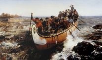
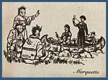
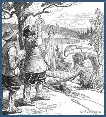
(3) Referred to as ‘The Battle of Moraviantown’ by Canadians and ‘The Battle of the Thames’ by Americans. Moraviantown (Sometimes Moravian Town) is located some 65 Km (40 mi) southwest of London Ontario.
Longitude & Latitude Co-ordinates:(Cut and paste co-ordinates in red into Google Earth to view Location)
Thames River at Riverside Drive & Wharncliffe Rd (Frigid Blue Reflection Photo)
42°58'51.72"N, 81°15'49.13"W
Thames River At University Bridge - University of Western Ontario
43° 0'28.46"N, 81°16'4.08"W
Fanshaw Lake Conservation Area
43° 2'48.30"N, 81°10'45.49"W
Forks Of The Thames (Downtown London Ontario)
42°58'53.47"N, 81°15'26.62"W
Springbank Park, London Ontario
42°57'28.00"N, 81°18'34.04"W
Moraviantown, Ontario (War of 1812 Battle site)
42°35'21.08"N, 81°53'50.12"W
Ball's Bridge - Maitland River (Huron County)
43°43'24.64"N, 81°33'23.83"W
Benmiller Ontario (Huron County)
43°43'10.23"N, 81°37'28.38"W


No comments:
Post a Comment