French River Revisited
Wolseley Bay to Big Pine Rapids And Back
(June 22nd & 23rd 1984)
 “Rest is not idleness, and to lie sometimes on the grass under trees on a summer's day, listening to the murmur of the water, or watching the clouds float across the sky, is by no means a waste of time.”
(June 22nd & 23rd 1984)
 “Rest is not idleness, and to lie sometimes on the grass under trees on a summer's day, listening to the murmur of the water, or watching the clouds float across the sky, is by no means a waste of time.”
Sir J. Lubbock
“The mark of a successful man is one that has spent an entire day on the bank of a river without feeling guilty about it.”
Chinese Philosopher
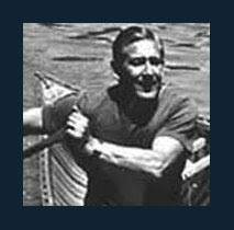
 There’s still time…..wadda ya think? Having completed our canoe trip on the Spanish River we were homeward bound along Hwy 69 when it occurred to us that there was still sufficient time to switch nationalities and revisit the French River. Sharing another day with a river certainly had greater appeal than waiting for the work week to resume, huddled in front of a shuddering air conditioner. Turning east on Hwy 64, Brian and I recalled the sweltering day we hitch-hiked this stretch of blacktop on a previous French River excursion. Hitch-hiking had been such an overly optimistic expectation as we continued our march along the gravel shoulder of county road 528 for much of it’s length. Curious locals and cautious vacationers occasionally sped by offering a cloud of dust in lieu of a ride. Sand & grit from the roadside made it’s way into my stiff new hiking boots and abraded my skin while my perspiration leached away the leather tanning dyes. It wasn’t until I arrived home that I realized the combination had tattooed permanent orange-brown socks onto my feet.
 Hwy 69 French River Marker
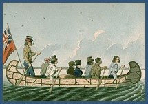
(Reads: 'Historic Site - Canoe Route To The West')
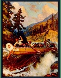
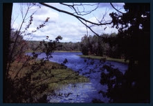
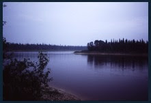
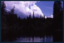
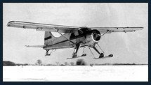
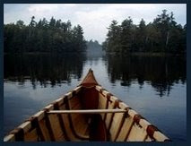
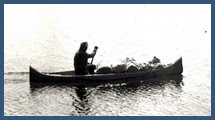
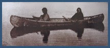
Depositing our car at Wolseley Bay, the eastern most cottage community on the French River, we tossed a quick overnight pack into the Grumman then pointed our bow south. I again recalled a foggy morn from a previous trip where it was almost impossible to see from bow to stern - only the haunting call of a distant loon pierced the wafting mist. In contrast, this bright afternoon had the gentle surface chop flashing with sunlight. Westward through Little Pine rapids brought us into the river proper where a short distance downstream, we beached our canoe on the north shore of Big Pine rapids.
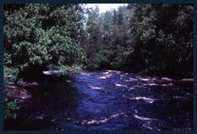
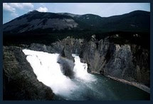
 Big Pine Rapids Looking Upstream - North Shore
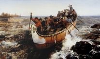
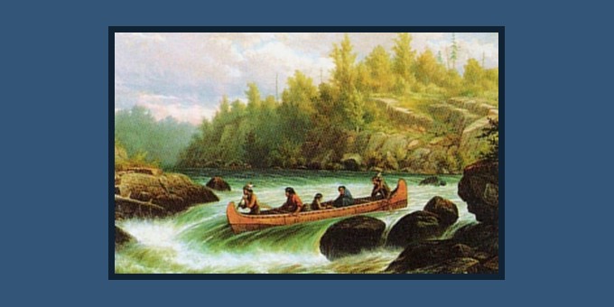
On each passing I felt humbled by this corridor of water flowing between two massive granite banks. Through this narrow passageway, notable explorers travelled westward, pushing back the frontier as they opened up the continent. Samuel De Champlain, Étenne Brûlé, adventurers Radisson & Groseilliers, Jean Nicollet discoverer of Lake Michigan, Pierre De La Vérendrye who opened the west and Cavelier De La Salle having built the first Great Lakes ship, the Griffon. All had at one time passed through these rapids and perhaps camped on the very spot we would choose to erect our tent.
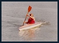
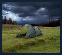
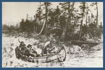
 With the roar of the rapids calling, the tent could wait. Tossing our gear ashore we made a quick scouting of the rapids and headed back upstream to set our approach to Big Pine. Numerous routes and options presented themselves and we explored all with repeated runs which consumed our carefree afternoon. Collapsing on shore we would dry out under the sun and the prevailing Georgian Bay breeze before regrouping for another bucking ride on the waves. I recalled our novice attempt at running these very rapids years earlier. Bravado prevailed over brains as we attempted to take a heavily laden fifteen foot Starcraft canoe down the chute. Big Pine had a different outcome in mind and gave us the ‘rocky finger’. Hanging up on a boulder, we spun broadside and quickly filled with water. Bobbing down the remainder of the rapids in the company of our scattered gear I lament to this day the axe and lantern I added to the historical artefacts that must lie at the foot of the rapids. Lesson learned although this French ‘immersion’ course I had not intended to take!
By firelight we reminisced about our previous adventures. Previously, friends had shared this river trip with us as far as the Hwy 69 bridge and on still an earlier occasion Brian & I had taken the French to Georgian Bay and beyond. It would be difficult to leave this old friend never knowing when we might return. But leave we did next morning, retracing our route upstream through Little Pine and back to Wolseley Bay where we would reluctantly rejoin the maddening hoards of civilization.
_________________________________________________Short Slide Show of Big Pine Rapids (1984)
(As seen from North Bank)
(Music: Knotty Pine - Gordon Lightfoot)


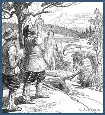
 Sign Reads: "as for me, I labour always to prepare a way for those willing after me to follow it"
Google Earth Co-ordinates:(As seen from North Bank)
(Music: Knotty Pine - Gordon Lightfoot)


 Sign Reads: "as for me, I labour always to prepare a way for those willing after me to follow it"
Copy & Paste Lat/Long Co-ordinates (everything in red) into the Google Earth search bar to be redirected to locations mentioned in this post.
Wolseley Bay Ontario:
Lat/Long - 46° 6'15.16"N, 80°16'3.31"W
Big Pine Rapids - French River:
Lat/Long - 46° 4'4.26"N, 80°12'21.10"W
 Road Map Of French River (Big Pine Rapids) Location
(Click On Map To Enlarge)

“The song of the river ends not at her banks but in the hearts of those who have loved her.”
Buffalo Joe© Copyright - All rights reserved.