French River Ontario - 1979
(Wolesley Bay to Key Harbour)

“I stand by the river and I know that it has been here yesterday and will be here tomorrow and that therefore, since I am part of its pattern today, I also belong to all its yesterdays and will be a part of all its tomorrows. This is a kind of earthly immortality, a kinship with rivers and hills and rocks, with all things and all creatures that have ever lived or ever will live or have their being on the earth. It is my assurance of an orderly continuity in the great design of the universe.”
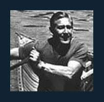
 Brian’s thumb began to droop and my cardboard sign declaring our destination “Wolseley Bay” was already soggy under my sweaty grasp. Hitchhiking!…… We were becoming depressed as car and camper alike sped by while we baked under the sun on the gravel shoulder of Hwy 69. Passive begging for a ride wasn’t working so our ever increasing frustration required a more aggressive tactic. Retreating to the service station at Key Harbour where we had stowed our car, Brian approached an elderly gentleman as he pumped gas into his chevy. Our non-threatening demeanour and pitiful pleading was thankfully sufficient in securing a ride as far down the highway as his destination allowed. Coffees in hand, his wife approached the car cautiously, casting a quizzical look at her hubby as two strangers peered out from the rear seat. All was well as we drove off in the last air conditioned luxury we would enjoy for the next week.

“I stand by the river and I know that it has been here yesterday and will be here tomorrow and that therefore, since I am part of its pattern today, I also belong to all its yesterdays and will be a part of all its tomorrows. This is a kind of earthly immortality, a kinship with rivers and hills and rocks, with all things and all creatures that have ever lived or ever will live or have their being on the earth. It is my assurance of an orderly continuity in the great design of the universe.”
Virginia S Eifert
 Brian’s thumb began to droop and my cardboard sign declaring our destination “Wolseley Bay” was already soggy under my sweaty grasp. Hitchhiking!…… We were becoming depressed as car and camper alike sped by while we baked under the sun on the gravel shoulder of Hwy 69. Passive begging for a ride wasn’t working so our ever increasing frustration required a more aggressive tactic. Retreating to the service station at Key Harbour where we had stowed our car, Brian approached an elderly gentleman as he pumped gas into his chevy. Our non-threatening demeanour and pitiful pleading was thankfully sufficient in securing a ride as far down the highway as his destination allowed. Coffees in hand, his wife approached the car cautiously, casting a quizzical look at her hubby as two strangers peered out from the rear seat. All was well as we drove off in the last air conditioned luxury we would enjoy for the next week.
Parting company at Hwy 64 we once again found ourselves pounding the shimmering tarmac. Cars occasionally whizzed by, offering momentary relief with the gust of air that followed in their slipstream. Spying a beautiful arm of sparkling water reaching for the sticky asphalt, I momentarily considered dropping my pack and jumping into that enticing cool blue oasis. The roadside sign marked the location as ‘Moonlight Bay’. Cued by the name, I began singing to myself The Guess Who tune ‘When Friends Fall Out’.
“The lone wolves howl
On Moonlight Bay
Dark moon is out
When friends fall out
When friends fall out”(1)
My feet were singing a different tune, orchestrated by the roadside sand and grit that had infiltrated my stiff new hiking boots. Still not broken in, each abrasive step grated away at my skin as I gingerly plodded along the gravel shoulder.On Moonlight Bay
Dark moon is out
When friends fall out
When friends fall out”(1)
Sporadic rides offered by sympathetic locals had finally delivered us to the far reaches of secondary highway 528. As we walked the final mile, the setting sun cast our shadows before us like compass needles pointing to the cottages of Wolseley Bay.
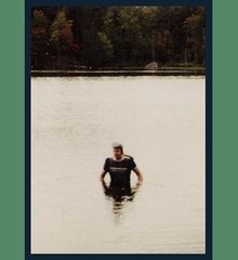
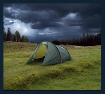
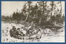
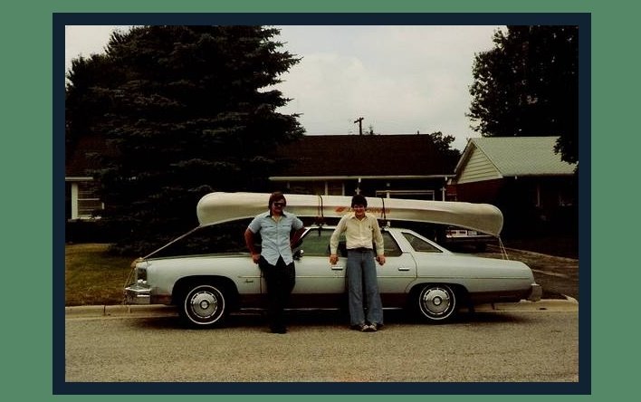
Such are the rigors of single canoe tripping. One car yet two destinations. Our canoe and gear had been deposited at Wolseley Bay much earlier that day. Stored under the watchful eye of an agreeable vacationer, we drove our car back to Key Harbour which, if successful, would be our final destination in about a weeks time. The gruelling sojourn back to our canoe had all but devoured the remainder of the day. After refreshments at the convenience store we haphazardly threw our gear into the canoe and baptized our paddles with the waters of the bay. Evening grew darker with each stroke so we set our sight on a distant island and doubled our pace for what would be our first night’s camp.
 Having shared opposite ends of the canoe on several previous occasions, Brian and I already had our camp routine down to a science. Fire built, tent pitched and kitchen erected, we now turned our attention to supper. Real food after our gruelling day! Opening my daypack, I retrieved the steaks purchased earlier that morning. Not much grilling on the glowing embers would be needed as they already appeared to be medium-rare courtesy of the mid-day sun’s relentless assault on our backpacks. Now, as the setting orb skimmed the tree line, waves shimmered tangerine against evening‘s cobalt sky. Repacking the canoe in a much more organized manner, we retired to the tent, lulled to sleep by the symphony of mosquitoes keeping time to the crackling percussion of our campfire.
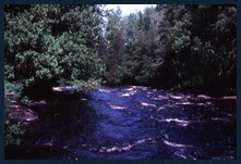
 As the rising sun attempted to burn away the mists of dawn, it also burned that morning’s image into my memory. Such an eerie sensation as the dense morning fog was pierced only by the bow of our canoe and the haunting cry of a distant loon. With the haze beginning to dissipate, the entrance to the French revealed itself on our right as the gentle sound of rolling water drew us to ‘Little Pine Rapids‘.
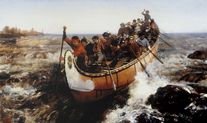
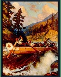
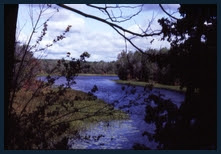
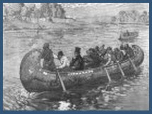
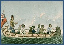
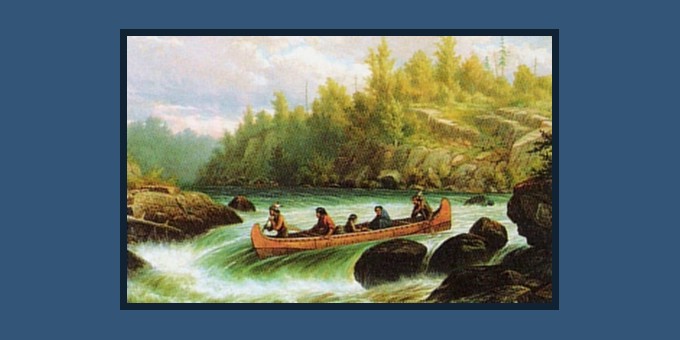
The French river was an intricate link in the chain of rivers used by early explorers and voyagers in opening the heart of Canada. Flotillas of canoes would travel these watery highways from Montreal, up the St. Lawrence, upstream on the Ottawa and then making the gruelling trip up the Mattawa to traverse the height of land. Caution was of utmost importance as the voyagers now entered the unpredictable Lake Nipissing. This large expanse of open water emptied into the French River which then, through various channels, provided access to the Great Lakes and further westward.

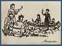
It was a rather humbling emotion that enveloped me knowing that historically significant explorers such as Samuel De Champlain, Étienne Brûlé, Raddison & Groseilliers, Jean Nicollet and Pierre De La Vérendrye had passed through this very channel centuries before. Fur trade had fuelled the exploration of Canada as the Coureur de Bois paddled these waters with bales of pelts destined for Montreal and Europe. Black robed Jesuit priests including Fr. Jean de Brebeuf and Fr. Gabrielle Lalemont dealt in a different commodity bringing Christianity to the Wendat (Huron) at the settlement of Saint Marie (among the Hurons). Tall, straight and robust white pine trees passed through this corridor making their way to England’s shipyards as masts for sailing ships. Through this narrow granite corridor, one paddled in the shadow of history.

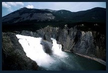
 Approach To Big Pine Rapids - French River
(as seen from north shore looking upstream)
As airplanes cue up in a landing pattern, we approached each chosen route on wings of water, waiting for the power of the current to grip the hull and take us to “the point of no return”. Every ride was exhilarating as the previous, weaving our way through the bucking waves to the foot of the rapids. When the adrenaline rush subsided, we would debrief each other in hopes of improving our technique for each following run.

Regrettably the advancing darkness forced us to finish our watery roller coaster rides and pitch camp. It was agreed. We would spend another day at this paradise.
 Big Pine Rapids Campsite
What had I stepped in? Poison ivy? Painfully itchy feet had woken me and unable to bear the discomfort any longer I crawled out of the tent to examine myself. The grit that had infiltrated my boots during our hike to Wolseley Bay had etched my skin as if I had been wearing socks made of sandpaper. Red and inflamed, I hobbled to the river’s edge and immersed my feet in the cool running waters. As in the cartoons, I could have sworn that a hiss followed erupting steam as it rose from my submerged limbs.
 Resembling kids at an amusement park, we re-ran Big Pine repeatedly, pausing periodically to dry ourselves, bask on the hot rock ledges while catching a few winks in the process.
A few ‘weekend warriors’ passed through our camp, landing to scout the rapids prior to attempting their own descent. The group of us chatted under sun drenched skies, marvelling at the magnificent river beneath. Our company remained long enough for us to trade turns descending ‘Big Pine’ while those ashore documented each others run on film.

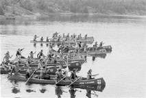
 Distant whoops and war cries had us convinced we had travelled back to another era. Upstream, voyager-like canoes carrying upwards of ten youngsters each, paddled with furious rate towards the opposite shore. A supervised excursion of schoolchildren were experiencing this river’s history firsthand. Campfires flickered across the waters where the distant echoes of their songs were periodically punctuated by youthful laughter.
 Another spectacular dawn found us packing our gear to the end of the ‘Big Pine’ portage having chosen not to make a final run that morning loaded with cargo. As a novice, I had learned that lesson well during a previous trip on these very rapids. After having hung up on a rock, the canoe twisted broadside against the current, pinning it against that granite obstacle as the boat filled from river flow. A rather embarrassing downstream trip, feet first and sans canoe ensued as assorted flotsam and jetsam bobbed around us as we floated our way to the foot of the rapids. Somewhere in the pool below, the waters must cover lost French coins, clay pipes and Indian arrowheads. My contribution to this historic time capsule was my axe and a naphtha lantern. I lament their loss with each passing trip.
 Below Big Pine, the gentle measured pace allowed one to drift into a state tranquil and hypnotic. Hours of ever changing vistas - observing the bobbing horizon or gently skimming along the tree lined shore. Chasing shadows cast by clouds upon the river, then, once caught, caressed by the warmth of the re-emerging sun. Squinting to best view the shimmering reflections on sparkling distant waves. Listening to rivulets trickle off the banks, weaving their tortuous journey around rocks and mossy logs to join the river’s never-ending flow. Subtle earthen odours with notes of pine needles laid upon the aroma of the river itself. A fragrance more pleasant than any concocted in Paris. Always wondering about what might be found around the next bend.
Paddles simultaneously freeze in mid-air, draining drops of water as they run down the shafts in search of the river. On the shore a deer has sacrificed the safety of the forest to quench it’s thirst at water’s edge. We watch, barely risking a breath. Raising it’s head, we momentarily observe each other - and then it is gone, leaving us with only a memory and a smile.
 Lulled into complacency by the gentle caress of the river we found that we had missed our channel and had taken an unintentional tour down the long arm of ‘Hammerhead Bay’. The sun was finally overtaken by the clouds permitting the mists to waft in. Each spoken word and stroke of the paddle gently reverberated against the granite walls of the inlet. This canyon was a blind alley which terminated after a few miles marked only by a weathered cabin tucked away amongst the trees. No current flowed here. This alone should have provided the clue to our dead end. The mist, now a drizzle began to wash the sweat from our brows as we traced our way back. Looking up, I resumed my gaze at the beautiful granite walls and towering pines of these backwoods. Backwoods, - another melody wove its way into my brain. As previously it was by Canada’s The Guess Who, but this was a song in tribute to one of my favourite folk artists, Gordon Lightfoot. Gord and his music is the embodiment of the Canadian wilderness experience. The tune was simply entitled ‘Lightfoot’ and the line that played out in my head was...
“He is an artist
He is an artist
He is an artist painting Sistine masterpieces of pine and fur and backwoods
Still echoes long ago the winter night of black July and then the outcome
Of an early Cleveland rainfall” (3)
He is an artist
He is an artist painting Sistine masterpieces of pine and fur and backwoods
Still echoes long ago the winter night of black July and then the outcome
Of an early Cleveland rainfall” (3)
Ah Gord! We should have gone left but were mislead by the larger body of water to our right. Running through some minor rapids we marvelled at the whirlpools formed by the various merging currents that chased each other. The current convinced us that we were on track once more.
The French River offers a choice of routes in downstream travel. The northern channel circumventing Eighteen Mile Island is somewhat wider however it is cursed by the proliferation of cottages and subsequent motor boat traffic. The more isolated southern channel is protected from most motorized craft by the number of rapids it offers. The relative isolation and challenging rapids of the southern branch make it the obvious choice for wilderness canoeists.
 As if on cue, the sun re-emerged illuminating our way to our next campsite. We stopped off on a small island mid-channel and found it so pleasant, decided to remain. The big draw was our discovering what seemed to be an inexhaustible supply of blueberries. Protected from foraging animals, the yield of cherry sized blueberries had bushes sagging from their weight. Hand over hand, we insatiably stuffed our mouths. Fistfuls until our hands and faces resembled Saturday morning smurfs. Blueberry tea, blueberry pancakes, blueberry oatmeal, blueberry chicken stew, blueberries for dessert, BLUEBERRIES!
Amongst the patches of blueberries lay patches of spongy moss. Pitching our tents on the moss would cushion our backbones from the granite backbone of the island. Propped up in front of our campfire, Brian and I were digesting nicely when morning’s drizzle made a repeat performance. Deciding to turn in, we made our way to our cushy beds.
 If not for the steady drumming of rain upon the tent fly, I might have thought I had become incontinent. My hands, tucked deeply inside my sleeping bag felt moisture - no, a puddle!!! I sloshed my way out of my soaked cocoon and found my rain gear submerged in yet another pool of water. Useless! Rousing Brian we broke camp amongst a slurry of curses. We had neglected to realize that moss, requiring moisture to grow, would find every depression on our island an ideal 'flowerpot'. Rainwater would fill these depressions nourishing the moss and the moss in turn acted as a biological sponge.
Soggy packs and containers of blueberries were tossed into the canoe as we pushed off for yet another day. Mist continued to waft down on us periodically as if canoeing in the produce aisle of the supermarket. Still, I find that these overcast rainy days bring a special magic to river travel.

Another rainy camp followed. It was disheartening to find that some irresponsible campers had desecrated this natural campsite with discarded glass bottles and other refuse. We cleaned up best we could as a rehydrated freeze dried meal bubbled and sputtered away on the fire. We would pack out the garbage to the roadside picnic area at the highway crossing. This trip was to court several rainy days and so it was as we once again pushed off. Our topographical maps announced that we were passing ‘Lost Child Bay’ to the north. Was the explanation of the name self evident? We wondered…


 A grey afternoon brought us into view of the bridge crossing Hwy 69. This location, etched into the recesses of my memory from years previous, held a special significance for me.
 Ten years previous, in 1969, my dad and I had taken a far too rare trip to the north country. Stopping off at the picnic area at the river crossing, we ate lunch while observing vacationers arriving in vehicles sporting distant licence plates. A commotion coming from below the bridge soon drew our attention. Two canoes, one capsized, bobbed along as its occupants laughed and splashed each other with water under the midday sun. I found it odd as the water below the bridge was calm and devoid of obstructions. What could have caused them to tip? Or was it just joyful frolicking on that sun drenched day? Their obvious enjoyment left me envious.
 My dad and I left the French River crossing that day in search of yet another Provincial Park and nightly campsite. Little did I realize that ten years hence, I would pass under that very steel trestle structure and remember that day long ago where my father and I had scratched our heads over the antics of the canoeists below.
Brian and I took advantage of this ‘rest stop’ to clean up and reorganize our canoe. Answering questions from several curious tourists, we took one last glance around and pointed the bow downstream.
Within earshot of the bridge the sound of the river can be heard dropping over what is best described as a ledge rather than a waterfall. The Ministry of Natural Resources had constructed a canoe tramway on the south bank of the French in order to circumvent Recollet Falls. This wooden slide allowed us to pull our fully loaded canoe around the un-runnable ledge with the least inconvenience. Proceeding downstream we once again chose an island for our nightly camp in hopes of finding additional berry treats. As the weather remained blustery, Brian and I huddled around the campfire sipping coffee and studying our topographical maps.


 River navigation is for the most part straightforward for in theory you put your canoe in one end and let the current take you to your destination somewhere at the other end. The situation becomes more complex when the river sprouts multiple channels and tributaries. Global Positioning Satellite units (GPS) had yet to make their way into the sportsman’s arsenal so navigation was for the most part by dead reckoning assisted by compass and topographical maps. The maps, based on 1950’s surveys, did not always reflect changes in channels due to erosion or fluctuating water levels. Aligning the map to magnetic north required the calculation of ‘declination’ which was the degree of drift of the earth’s magnetic field from when the survey was made to that of present day. Much more critical in activities such as hiking and orienteering where there is no river guiding the direction. Nevertheless, knowing one’s precise location confirms distance travelled and helps to predict promising campsite locations.
 Our current location was on the edge of one top map as it ran into the next. Weighing down the abutted maps with rocks, we contemplated our next days plan of action. Three channels presented themselves as options as the river turned southwards in it’s run to Georgian Bay. The most westerly channel, often referred to as the ‘voyageur channel’, appeared to be the primary branch however this route would extend our trip back to Key Harbour all the while exposed to Georgian Bay’s unpredictable weather. The eastern channel appeared small but navigable as did the slightly wider central channel. With time and safety in mind we decided to make our way down the first and most easterly channel. As I started to trace the route with an indelible ‘Sharpie’ marker a sudden gust of wind erupted, blowing hot embers our way. Jumping up we brushed away the smouldering coals from ourselves and the maps. Unbeknownst to me the gust of wind had raised our maps and laid them down in a slightly altered position. The change was unperceivable at that time but the three channels had shifted so that the eastern channel was now overlaid on the central channel. Concentrating on that route, I perfectly and precisely navigated us down the wrong channel.
 Some confusion did occur as we circled around in a bay trying to find some prominent landmark to identify our position. By chance two fishermen happened upon us in this secluded location and were able to advise us to an escape route. Embarrassed, yet this error may have been to our advantage as the river’s flow was directed down several chutes, each so narrow we could barely squeeze through to the bay. The smaller eastern channel might have presented an even more challenging route.
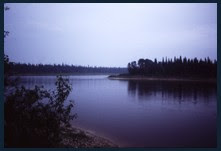
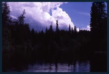
 We bade the French farewell as we entered the waters of Georgian Bay. Sunset descended, but with this new landscape, where were we to make camp? Here an eerie violet sky was mirrored in the still magenta waters of the bay, broken by countless rocks of varying sizes where they protruded through the glassy surface. From boulders to islands, the bay was punctuated with these obstructions as far as the eye could see.
 This area was known as ‘The Fingerboards’ in reference to the dot markers, notes on a guitar’s neck. Choosing a larger treeless island we pulled our canoe onto the rock and scouted it end to end. Other than the view, it had not much to offer. Erecting our tents, keeping well clear of any mossy bedding, we began scouring the shoreline for driftwood. Gathering broken branches piece by piece we retreated to the fire pit to stoke the flames then attack again in search of more fuel. Reaching through the twilight I was about to grasp a branch when it rattled and slithered off. Startled, I jumped back, realizing I had mistaken a rattlesnake for kindling under this failing light. We were much more cautious in our selection after that episode and discovered that even more rattlers shared their home with us that evening. We kept our tents zipped up tightly that night in fear of having one of these cold blooded creatures crawl into our sleeping bags in search of warmth.
In spite of mornings gusty winds, there were few whitecaps on the bay, allowing steady progress as we caressing the shoreline. Far off to the right sat ‘Bustard Island’ against which we could measure our progress. Larger boats began to appear as vacationers from cottages and marinas alike explored this shoreline. Stopping for lunch on what could only be described as a wind buffeted rock, we could barely keep a can of sterno(4) lit to warm our coffee. Crackers, peanut butter and some gorp(5) restored our energy to continue paddling.
 If my navigating had not erred as it had previously, the inlet ahead was the entrance to Key River and not Henvey Inlet to the south. We entered the sheltered arm of water as the cooling wind surrendered to the warming sunlight. Soon after we came across a rather quiet marina where we docked and sprinted ashore to a Coca Cola machine found standing outside the front door. In a frenzied state, we routed around for change which had found it’s way to the lowest recesses of our packs. Exchanging coins for soda, we stood there savouring the frosty flavour. It wasn’t so much that I missed ‘soda-pop’, as river water was quite palatable. What I missed most of all was having a drink that was ice cold!
The final stretch of a journey is always bittersweet. The anticipation of finishing is always tempered by the reluctance to end an enjoyable river trip. We had arrived at Key Harbour from which we had departed a week earlier.
 It wasn’t until weeks later while taking a shower that I inspected the feet that had irritated me so much during the start of the French River trip. It seemed that the dirt would not wash away. But was it dirt? It almost appeared that I was wearing socks of a shade slightly darker than my skin. But it was my skin! What I believe had happened was that those unbroken new hiking boots were so stiff that during my hike back to Wolseley Bay that the sand and grit which had infiltrated my footwear etched my skin. With the combination of the abrasive material, the tight sweaty boots and the tanning leather dye, I had managed to tattoo myself the same shade as the leather. Though somewhat faded, to this day I continue to wear what I call my ‘French River socks’ as a permanent reminder of that trip
I was to canoe the French several more times in future days but some excursions are just more memorable than the others.
 ***To see a short slide show of Big Pine Rapids on the French River, Click on the link below to redirect to a supplemental post on this blog entitled;
(1) When Friends Fall Out - American Woman, 1970 -The Guess Who
(2) Downstream ‘V’s appear as the water flowing between two rocks indicating clear passage. An Upstream ‘V’ has a rock at the apex - an obstacle that should be avoided.
(3) Lightfoot - Wheatfield Soul, 1968 - The Guess Who - Full lyrics of 'The Guess Who's' tribute tune to Gordon Lightfoot can be found at the bottom of the right hand blue sidebar of this blog.
(4) Sterno - gelled alcohol based fuel in a can which can be opened and lit.
(5) GORP - Good Old Raisins and Peanuts. Basically any dry nut, seed and fruit mix.
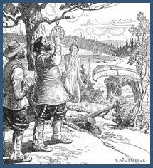
 Plaque reads: “as for me I labour always to prepare a way for those willing after me to follow it”
 Google Earth Co-ordinates:
(cut and paste everything after the dash- (in red) into Google Earth search bar.
(cut and paste everything after the dash- (in red) into Google Earth search bar.
Wolesley Bay - French River Jump-off
Lat/Long- 46° 01’09.03” N, 80° 34’ 58.45” W
French River & Hwy 69 Bridge
Lat/Long- 46° 01’ 09.03” N, 80° 34’58.45” W
Recollet Falls
Lat/Long- 46° 01’01.70” N, 80° 36’18.78” W
Fingerboards-Georgian Bay
Lat/Long- 45° 53’ 53.05” N, 80° 33’ 41.63” W
Key Harbour (off of Key Inlet - Finish)
Lat/Long- 45° 53’ 39.89” N, 80° 33’41.63” W
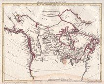
 French River - Click On Map To Enlarge
Lat/Long- 46° 01’09.03” N, 80° 34’ 58.45” W
French River & Hwy 69 Bridge
Lat/Long- 46° 01’ 09.03” N, 80° 34’58.45” W
Recollet Falls
Lat/Long- 46° 01’01.70” N, 80° 36’18.78” W
Lat/Long- 45° 53’ 53.05” N, 80° 33’ 41.63” W
Key Harbour (off of Key Inlet - Finish)
Lat/Long- 45° 53’ 39.89” N, 80° 33’41.63” W
 French River - Click On Map To Enlarge
"I, a light canoe will build me...that shall float upon the river, like a yellow leaf of autumn, like a yellow water lily!"
Hiawatha


© Copyright - All rights reserved.