
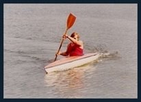
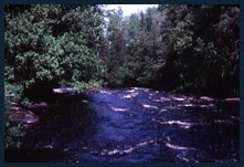
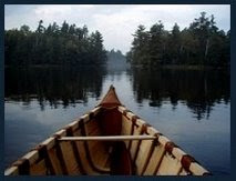
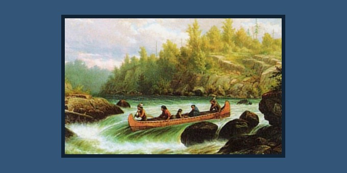
 (photo of Mackenzie River above courtesy of my good friend Sharon Layne)
 I thought that in this post I might supplement some of the ‘Tales’ presented in this Blog, with some of the source material we used in preparing for, or which helped direct us down the various rivers mentioned in hopes other might find it amusing if not helpful.
I shall have to see what material I might locate that might be of interest to the reader and perhaps periodically add it below.
 The number of hits I receive on my Albany River Tale reveals the interest canoeists and other adventurers have in this somewhat remote route in the “near north“. To supplement the information already presented in my story, I searched through my files and transcribed the original Ontario Ministry of Natural Resources (MNR) route description of the Lower Albany River route we used (Limestone Rapids on Kabinakagami River, to Kenogami River to the Albany River and onwards to Fort Albany on James Bay). Although updated descriptions are no doubt available through the MNR or canoeing organizations, I thought it might be of interest to include the original description, word for word, as received in that blustery winter of 1982, as we planned this adventure.
One must remember that these were the days before the internet, Google Earth, cell phones and GPS. The mimeographed route description & hand drawn map (below), scribbled notes, topographical maps and a pocket compass were all that helped direct us down the Albany River to the bay. Note as well, distances provided in feet and miles - prior to the province of Ontario and Canada making metric the official scale of measure.
Ontario Ministry of Natural Resources
Official Route Description
(compiled c.1970's)
Canoe Trip From Limestone Rapids To Fort Albany
Official Route Description
(compiled c.1970's)
Canoe Trip From Limestone Rapids To Fort Albany
The trip down the Kabinikagami River to the Kenogami River, down the Kenogami to the Albany River and down the Albany to Fort Albany is an excellent canoe trip. The trip starts at the foot of Limestone Rapids which is reached by car, going twenty miles west of Hearst and turning north at the turn to Calstock on the Rogers Road, then driving twenty-five miles north past the Calstock Indian reserve to the foot of the Limestone Rapids. Vehicles may be left at a commercial garage at Hearst or at the Ministry of Natural Resources Office on the Rogers Road about eight miles south of the Limestone Rapids or on top of the hill above the rapids. The water route is about 250 miles long. Traveling approximately eight hours per day with a fully-loaded 16' canoe and a 3 H.P. Motor, the trip takes about 6 days. Top speed with the above equipment is approximately 7 ½ m.p.h., using about 2 ½ gallons of gasoline per day. Probably a 5 ½ H.P. Motor with a larger canoe would be better as a 3 H.P. will not push a 17' canoe back up the average rapids, in case this is necessary due to a missed turn or other reason. Paddling a canoe will take approximately 10 days,. A drop in elevation of 500 feet from the Limestone Rapids to Fort Albany ensures an active current all the day.The information provided here was obtained from a trip made the fourth week in September. The water level was considered about average summer level. However, there is quite a fluctuation in water level and it would be well to check with the Ministry of Natural Resources at Hearst, in case of unreasonably low water in the Kabinakagami River, which would be a guide to what might be expected on the rest of the trip. Portaging is not necessary on this trip, although on some rapids you may have to walk beside your canoe.
The first day, depending on the equipment used, should see on pass the old, now deserted, trading post at Mamammatawa and reach the Ash River. Pure stand of spruce and mixed stands of spruce, birch and poplar are common along the whole route. There are a dozen rapids from the Limestone Rapids to the Ash River. Four of those were paddled down and the rest were run with the motor going.
The second day should see one fairly close to the Albany River. Campsites are scarce, once the mouth of the Current River is passed. The Ogoki Indians use a site about six miles north of the Current River, on the west bank, as a base fro which to fish Sturgeon. Moose, bear and wolf tracks were noted and some flocks of Canada geese. The Drowning and Current Rivers are quite shallow and fast. The Kenogami River is quite wide (¾ mile), and while there were no serious rapids, occasionally the motor hit a gravel bar and often in mid-stream. In fact, generally, deeper water was found near either shore.
The third day should put one close to Hat Island. The Albany is quite wide, approximately ½ mile. Good campsites are very scarce and it may be necessary to camp on what is probably a flood plain about 15 feet above the river level. These sites are inclined to be rocky and sometimes springy. A good ground sheet and either a safari cot or air mattress is recommended. This type of campsite is common all the rest of the way. Tent poles and wood are no problem. It may be necessary to get out and walk beside the canoe at the mouth of the Henley River. There are half a dozen rapids from the junction of the Kenogami and Albany River to Hat Island. Two rapids were paddled, about three miles before the Tchakashapug River. The best channel is on the north side of Hat Island. It was noticed that where there were islands, quite often there were rapids.
The fourth day should put one between Norran and Black Bear Island. There are approximately fifteen rapids and swifts between Hat Island and Black Bear Island, most of them opposite islands. There is also one rapid about 2 ½ miles above Chipie Island(1), and another where the river widens to go around Chipie Island. The south channel around Chipie Island was quite good. The south channel around Norran Island was taken. It was necessary to paddle for a while because of rapids on both the south and each side of the Island. Flocks of Canada Geese were becoming more abundant.
The fifth day should see one close to the first rapids marked on the Albany River by R ø appropriately 25 miles up river from Big Island. Passing Black Bear Island through the channel to the north are numerous but not bad rapids. The west channel past the first island, beyond Black Bear, proved the best. Six rapids were easily run from the first island shown on the map. The north channel past this very large island was taken. The north channel was taken through the group of what appears on the map as nine islands. Five minor rapids were run. However, in the north channel opposite the last island in this chain, (therefore the one marked R ø) was a very swift deep rapid which resulted in large choppy waves. This is marked “Bad Rapids No. 1” on the attached sketch. Quite a bit of water was taken over the bow of the loaded 16' canoe. This was by far the worst rapids so far. It might be well to check the channel on the south side of this island, particularly, if small, well-loaded boats are being used.
The end of the sixth day should see one at Fort Albany, if not mislead into thinking that all the channels shown on the map actually have water in them. Many people have lost one to three days trying to find their way to Fort Albany through the maze of islands and blind channels. Expectations that the first R ø marked on the map could be a bad rapid proved in error. There were no rapids in the east channel here. There were eight rapids from this point, to where the River widens around the first island, in the chain of islands in the mouth of the Albany River. These rapids presented no special problems. From here on please study your map and the attached sketch carefully. It is very easy to get confused.
A route going south of Big Island but is suggested to avoid the second rapids in the north channel down the river from the western tip of Big Island. (Marked “Bad Rapids No. 2” on the attached sketch). This rapid is the most dangerous on the whole trip. What makes it dangerous is a ledge which cannot be seen until one is right on it, and then it is too late to select the best channel. The drop at the ledge is only about two feet but in the wrong spot it could cause trouble. Check this rapid before trying it or take the south side of Big Island. The fact that Fort Albany is not on Albany Island as shown on the map, is confusing. (check attached sketch). Add to this, changes made in the shapes of islands by river action and in the last few miles by fluctuating water level due to tides, and the reason for careful study of the route is obvious. A little information on tides might be useful. High water level is called high tide and low level is called Low Tide; this sequence occurs twice every day. There is 6 hours 12 ½ minutes between high and low tide. Tides vary in range, but may be from two to eight feet in channels near the coasts in this area. New moon and full moon usually produce higher than normal tides; winds also play an important role. Hundreds of Canada geese were seen in the estuary of the Albany River and thousands of Blue Geese along the coast.
The alternate route to avoid Bad Rapids #2 goes around the south side of Big Island and is also shown on the attached map. Also shown is the best route to follow to get into the settlement of Fort Albany by following the north side of Sinclair Island.
Austin Airways (2) have regular flights between Fort Albany and Moosonee. It is suggested to contact them for more information about schedule and flying out equipment.
From Moosonee, the Ontario Northland Railway runs to Cochrane and Austin Airways flies to Timmins. Buses run from Cochrane to Hearst.
If one decides to go to the Cree Indian Settlement on the north shore of the Albany River (3), radio contact with Austin Airways can be made there to have them make a stop.
Aside from the equipment mentioned above, hip waders, a rain coat and warm clothes can be most welcome. A few spare shear pins and even a spare propeller may come in very handy. A 50ft. Rope will be useful if it is decided to line a canoe down any of the rapids.
It is hoped that this information will help make your trip a truly enjoyable experience.
Maps suggested by the MNR which appeared following the above description been omitted here (4).
 (click on map to enlarge)
Above is the hand draw map we received from the Ministry of Natural Resources. This was our only guide other than the topographical maps we brought with us. No GPS!!
 (click on photo to enlarge)
Current: Above is a portion of the Albany River Delta (Google Earth) showing the complexity of channels which the canoeist must deal with in reaching Fort Albany. Navigability of channels change with the tides and with the seasons. Again, no GPS in 1983!
(1) Appeared as Cheepay (not Chipie) on top map we used.
(2) Aircraft under the company name of Austin Airways no longer service this area. In June of 1987, Austin Airways, formed in 1934, merged with Air Ontario Ltd (formerly Great Lakes Airlines) to form Air Ontario Inc. which in turn became part of Air Canada Jazz in 2001. The area formerly flown by Austin Airways is now serviced by Air Creebec. More information can be found on their website.
(3) The settlement referred to is probably Kashechewan.
(4) Maps suggested by the MNR are 1:250,000 scale. We used a combination of 1:250,000 and 1:50,000 when available as they provided greater detail. Maps use on our trip are listed at the end the account of our trip Albany River. Maps of either scale can be obtained through the Canada Map Office or Federal Publications.
The same Albany route discription offered in the out of print MNR publication 'Canoe Route Of Ontario' (see sidebar) reads as follows;Dozens of rapids churn along these isolated rivers and a steady drop in elevation ensures an active current all the way. An abandoned trading post at Mammamattawa at the junction of the Kenogami and Kabinakagami Rivers recalls the history of the Hudson's Bay Company in the area. The Ghost River post on the Albany River still functions during the fall and winter fur trade. Moose, bears and wolves roam the muskeg wilderness and stands of spruce, birch and poplar are common along the entire route.
Although there are no portages, some of the rapids may need to be lined. At least two sets of bad rapids on the Albany Rive should be avoided by choosing alternate channels. The Ministry of Natural Resources office in Hearst should be contacted to check water levels in the Kabinakagami River. Campsites are scarce past the mouth of the Current River and it may be necessary to camp on the rocky riverbank five meters above river level. The last stretch of the trip can be very confusing and thorough study of the maps and detailed information is necessary to avoid getting lost for days in the maze of islands and blind channels. The last few kilometers of the trip will be affected y winds and tides of James Bay. Rain gear and winter clothing are essential. Fishing - pickerel, pike and brook trout.
Magnetawan RiverThe Magnetawan River Canoe Route
“The Magnetawan River, rising in the foothills of the Algonquin Park Highlands and flowing west 100 river miles to Georgian Bay, cuts Parry Sound District fairly in two across its middle.”
The River is navigable from Burks Falls in the east through to Britt on Georgian Bay. However, the Parry Sound District of the Ministry of Natural Resources maintains access points, campsites and portages from Wahwashkesh Lake to Harris Lake as indicated on the Regional Setting Map.
Access Points
Parking and boat launching facilities are provided at both the Harris Lake Access Point off Highway #69 (4.6 kms) and the Wahwashkesh Lake Access Point from Highways #124 and 520. (45 Km)
Magnetawan River History
Lumbermen found several faults with the Magnetawan. At first, it flowed in the wrong direction away from the St. Lawrence River centered markets and when the building of the U.S. Midwest did create a demand for the region's pine, prevailing westerly winds tended to stall log drives for days on end on the lakes and along stretches of slack water that periodically interrupted its flow toward the bay at Byng Inlet (Britt). Then, there were the frequent rapids in which longs jammed in huge masses if not handled just right. Sometimes, the nerviest man in the gang had to be lowered by rope down the canyon wall of the notorious Canal Rapids to “pick” a log jam free. The Thirty dollar rapids, known to canoe-trippers for its two mile portage reportedly was so named after an entire drive of longs stuck in its jagged throat for a whole month and this cost the company a months pay for each member of the gang.
Journey back in the Magnetawan River's history to an era when logging and hearty men were a common sight (1870 – 1910). An era when pointer boats, tent camps, log booms and a fiddler's music were common. Men of the past leave us there footnotes to reflect upon.
Carve island
Westerly winds often delayed river drives. At this island over the years stranded drivers developed a tradition of carving the logged pine stumps into birds and animals.
Three Snye Rapids (MacArthur ~1926~)
“Three Snye dam, a real old time structure, was built over 40 years ago (1886) without nails, wooden plugs holding the squared timbers together...Here it is that one will lie awake rolled up in his blanket while a light mist rolls up from the rapids and low-lying water...and to the tense ear and awakened imagination will come the rattling of massive chains, the creaking turning of the windlass over the gates.”
The Graves (MacArthur ~1926~)
“Not far above the shallows where the creek enters the Magnetawan, is a plot of ground on a sunny slop, with a cedar fence surrounding it. Here are the graves of two river drivers drowned in the canal thirty years ago (1896) running a pointer boat through. The spot is tended to each spring by the passing drives. Gone are most of the curios left by fellow workers – the corked shoes, pipes. Broken watch cases, and other knicknacks. The carved doves that rested over the head pieces, miniature “peaveys” and pike poles, marauding tourists have lifted.”
Deer Lake Dam (Tom Keating ~1965~)
“Have you ever been at that Dam at Deer Lake? I saw two fellows go through that on a log. They each picked a log, and dared one another and struck off. And the one couldn't swim...By God, that was dangerous. See you couldn't tell what the log's going to do...The both had to leave the log they went through on, but the eddy was full of logs below. They must have been smashed all to pieces. Foolish thing. But they came out, they was all right”
* * *
The following description comes from 'Canoe Routes Of Ontario' published by the Ontario Ministry of Natural Resources.
Magnetawan River Loop
120 km / 4 to 7 days
Portages 18 / 2.3 km, 2.4 km, 1.4 km, 1.4 km
Main Bodies Of Water
Wahwashkesh Lake, North Magnetawan River, Harris Lake, South Magnetawan River, Big Bay, Miskokway and Bolger Lakes
Start/Finish – Wahwashkesh Lake by road (off Hwy 520)
Intermediate Access – Harris and Naiscoot Lakes by road off Hwy 69)
This circular rout flows throgh a representative souther Sheild landscape of predominantly pine and birch forest and gneiss and granite outcrops. The area is steeped in the history of the white pine logging era, and remnants of dams, camboose camps and loggers graves can be explored at various points. The Magnetawan River crated several obstacles for the lumbermen. The Magnetawan River markets centered on the St. Lawrence; prevailing winds could stall log drives to the American Midwest for days; and the frequent rapids had to be navigated precisely to prevent massive log jams. At Carve Island, wind-bound log drivers developed a tradition of carving logged pine stumps into birds and animals. The wildlife of the area includes beaver, bear. Deer. Moose, otter, mink, great blue heron, merganser, ruffed grouse and woodcock. Cottages line Wahwashkesh, Harris and Maple Lakes and settlement is low to medium along the South Magnetawan, however, human habitation is limited to an occasional hunt camp.
Canoeists will be exposed to moderately challenging white water and will need a general understanding of river travel. The route is passable throughout the canoeing season by canoeists with whitewater experience, except for the Crooked Rapids, which become a series of falls and ponds in the summer. Major rapids are potentially hazardous during the spring runoff. Variations in this rout make possible a shorter circular rout or either of two linear trips. These are shown in the brochure. Campsites are abundant, but problems with latrine facilities (due to shallow soil cover) and difficulties docking canoes along the steep shoreline, must be considered. Drinking water from lakes with dense cottage development requires treatment. Fishing – pickerel, pike, perch, smallmouth bass, lake trout; ciscoe in lakes.
 Magnetawan River Canoe Loop Route
(Click On Map To Enlarge)
(Not the route in my Tale post in this Blog, but one the readers might enjoy trying)
 General location of Magnetawan River
(Click On Map To Enlarge)
 Province Of Ontario Roadmap - Location & Access to Magnetawan River
(Click On Map To Enlarge)
(Red Arrow points to Ahmic Harbour where we started our abbreviated journey)
(note also in upper right Bustard Island & Key River mentioned in my French River Tale)

The Restoule & Upper French River Canoe Routes
(including map of the Dokis Canoe Route variation)
As in the previous entries on this post, these words are not my own but those found on the Ontario Ministry of Natural Resources (MNR) notes and publications. The Route description presented here is not in whole identical to what I canoed in my tale 'Restoule River - In Remembrance Of A Friend', however it is offered here in hopes it may be of interest to some reader.
Description of Route
Starting from any of the access points in Restoule Provincial Park, proceed westerly along the north shore of Restoule Lake to the 35 m portage #1 which cuts across the base of Angel's point. You may paddle around the point if you wish. Turn right and follow the river to the second portage #2 (90 m) which bypasses Grawbarger's (Restoule) Rapids. When water conditions are favourable you can float through this area with no difficulty. Easy access by automobile possible if you wish to make this your embarkment point.
A short distance downstream you emerge into Stormy (Patterson) Lake, where a public launch site is located for those not staying in Restoule Park. Here yo may fish for pickerel, bass, pike, muskie and lake trout. Proceeding westerly out of Stormy you enter the Restoule River which, until it reaches Scott's Dam some 5 km distant, has the characteristics of a long narrow lake. A well-marked portage #3 (270 m) at the north end of Scott's Dam leads down to the Restoule River below the rapids. Some care should be taken at this portage to avoid contact with poison ivy. As yo progress below the poison ivy. As you progress below the portage ½ km downstream there is a logging bridge across a narrow section. During high water when Scott's Dam is open it is wise to use caution at this site.
Travelling by a deep pool and over a short sand bar brings o into Lennon Lake. Its rocky and sandy shores are covered with red and white pine, poplar and white birch trees. Lennon is perhaps the most scenic lake on the rout. Watch the south shore for two pine-covered points with excellent campsites.
At the outlet of Lennon Lake is McArthur Rapids with a portage #4 (270 m) on the north side. This will bring you onto the Restoule River below the rapids. Here the river is narrow and shallow but it soon widens and meanders through a marshy area. About 2.5 km below the portage is a campsite established on the south or left shore. This campsite is a likely spot to observe wildlife in the evening, however mosquitoes may be a problem in the early summer.
As you travel on down the river some 5 ½ km from McArghur's Rapids you come to Keesaw Portage #5 (900 m) on the right shore. The trail crosses a bridge over the Restoule River and follows a gravel road which comes in below the Chaudiere Dam. Downstream of the bridge is a scenic gorge and falls. Cold drinking water is available from a spring on the west side of the road where it meets Restoule Bay.
Paddle west out of Restoule Bay and after 2 ½ km round the point where the shoreline breaks sharply to the northeast. Along the French you will notice a marked change in the shoreline with large areas of open flat rock and jackpine.
A group of small, flat rock islands and a larger island near the west shore called 'Boom Island' are encountered. During fast water conditions it may be necessary to prtage across Boom Island #6 (55 m).
Follow the eastern channel of the French northeast to the portage which by passes Chaudiere Dam. (Note that on the topographic map, this dam may be incorrectly located on the west channel). This protage #7 (900 m) is called Champlain Trail, named after the famous French explorer who used this water route during his explorations. The trail crosses the same road encountered at the Restoule River above Keesaw Rapids. This trail ends at the 'Upper French River'. From here to the mouth of Shoal Creek, there is no currant as the Upper French is actually part of Lake Nipissing.
Supplies, telephone, gas and oil can be obtained by taking an interesting sid trip to the Dokis Indian Village located about 1 km west of the portage.
As you progress eastward, you will pass through large open stretches of water with numerous pine-covered, rocky islands. Fishing for pickerel and pike is excellent. Campsites are numerous but an exceptional sandy, large site is located at the mouth of Shoal Creek in Frank Bay.
Shoal Creek winds through a flat, marshy, area flooded by beaver dams with three shrt portages on the east or left side of the creek. Portage #8 (90 m), Portage #9 (55 m), Portage #10 (45 m).
This 8 km journey ending at Shoal Lake will take about half a day.
Wildlife is abundant along the creek.
Part-way up the west side of Shoal Lake is a good campsite called 'Whiskey Point'. Reentering the creek at the southwest corner of Shoal Lake you pass through a marshy area for 5 km and arrive at Bass Lake portage on the northeast shore Portage #11 (810 m).
Bass Lake is a good place to spend a couple of days fishing, as bass, pickerel, and pike abound in the numerous weed beds. Many open, flat rock areas offer good camping spots. The portage out of Bass Lake #12 (900 m) is due south across the widest part of the lake. Along the trail are very scenic stands of red and white pine.
The portage from Bass Lake ends on the south shore of Clear Lake (Watt Lake) which is joined to Stormy Lake by a short narrows. After crossing Stormy Lake, arrive at the public access point or travel back up the river past Grawbarger Rapids, across Angel's Point and back to Restoule Park.
Access – Restoule Provincial Park for campers staying at the park.
Alternate Access – Patterson Lake for others.
MNR Suggested Topographical Maps
Nipissing 31 L/4
Noelville 41 I/1
 (Click on map to enlarge)
 (Click on map to enlarge)
 Roadmap indication access to Restoule Provincial Park
(Lake Nipissing, Wolesely Bay, French River, Restoule Rivers Included)
(Click on map to enlarge)
Description of Route
Starting from any of the access points in Restoule Provincial Park, proceed westerly along the north shore of Restoule Lake to the 35 m portage #1 which cuts across the base of Angel's point. You may paddle around the point if you wish. Turn right and follow the river to the second portage #2 (90 m) which bypasses Grawbarger's (Restoule) Rapids. When water conditions are favourable you can float through this area with no difficulty. Easy access by automobile possible if you wish to make this your embarkment point.
A short distance downstream you emerge into Stormy (Patterson) Lake, where a public launch site is located for those not staying in Restoule Park. Here yo may fish for pickerel, bass, pike, muskie and lake trout. Proceeding westerly out of Stormy you enter the Restoule River which, until it reaches Scott's Dam some 5 km distant, has the characteristics of a long narrow lake. A well-marked portage #3 (270 m) at the north end of Scott's Dam leads down to the Restoule River below the rapids. Some care should be taken at this portage to avoid contact with poison ivy. As yo progress below the poison ivy. As you progress below the portage ½ km downstream there is a logging bridge across a narrow section. During high water when Scott's Dam is open it is wise to use caution at this site.
Travelling by a deep pool and over a short sand bar brings o into Lennon Lake. Its rocky and sandy shores are covered with red and white pine, poplar and white birch trees. Lennon is perhaps the most scenic lake on the rout. Watch the south shore for two pine-covered points with excellent campsites.
At the outlet of Lennon Lake is McArthur Rapids with a portage #4 (270 m) on the north side. This will bring you onto the Restoule River below the rapids. Here the river is narrow and shallow but it soon widens and meanders through a marshy area. About 2.5 km below the portage is a campsite established on the south or left shore. This campsite is a likely spot to observe wildlife in the evening, however mosquitoes may be a problem in the early summer.
As you travel on down the river some 5 ½ km from McArghur's Rapids you come to Keesaw Portage #5 (900 m) on the right shore. The trail crosses a bridge over the Restoule River and follows a gravel road which comes in below the Chaudiere Dam. Downstream of the bridge is a scenic gorge and falls. Cold drinking water is available from a spring on the west side of the road where it meets Restoule Bay.
Paddle west out of Restoule Bay and after 2 ½ km round the point where the shoreline breaks sharply to the northeast. Along the French you will notice a marked change in the shoreline with large areas of open flat rock and jackpine.
A group of small, flat rock islands and a larger island near the west shore called 'Boom Island' are encountered. During fast water conditions it may be necessary to prtage across Boom Island #6 (55 m).
Follow the eastern channel of the French northeast to the portage which by passes Chaudiere Dam. (Note that on the topographic map, this dam may be incorrectly located on the west channel). This protage #7 (900 m) is called Champlain Trail, named after the famous French explorer who used this water route during his explorations. The trail crosses the same road encountered at the Restoule River above Keesaw Rapids. This trail ends at the 'Upper French River'. From here to the mouth of Shoal Creek, there is no currant as the Upper French is actually part of Lake Nipissing.
Supplies, telephone, gas and oil can be obtained by taking an interesting sid trip to the Dokis Indian Village located about 1 km west of the portage.
As you progress eastward, you will pass through large open stretches of water with numerous pine-covered, rocky islands. Fishing for pickerel and pike is excellent. Campsites are numerous but an exceptional sandy, large site is located at the mouth of Shoal Creek in Frank Bay.
Shoal Creek winds through a flat, marshy, area flooded by beaver dams with three shrt portages on the east or left side of the creek. Portage #8 (90 m), Portage #9 (55 m), Portage #10 (45 m).
This 8 km journey ending at Shoal Lake will take about half a day.
Wildlife is abundant along the creek.
Part-way up the west side of Shoal Lake is a good campsite called 'Whiskey Point'. Reentering the creek at the southwest corner of Shoal Lake you pass through a marshy area for 5 km and arrive at Bass Lake portage on the northeast shore Portage #11 (810 m).
Bass Lake is a good place to spend a couple of days fishing, as bass, pickerel, and pike abound in the numerous weed beds. Many open, flat rock areas offer good camping spots. The portage out of Bass Lake #12 (900 m) is due south across the widest part of the lake. Along the trail are very scenic stands of red and white pine.
The portage from Bass Lake ends on the south shore of Clear Lake (Watt Lake) which is joined to Stormy Lake by a short narrows. After crossing Stormy Lake, arrive at the public access point or travel back up the river past Grawbarger Rapids, across Angel's Point and back to Restoule Park.
Access – Restoule Provincial Park for campers staying at the park.
Alternate Access – Patterson Lake for others.
MNR Suggested Topographical Maps
Nipissing 31 L/4
Noelville 41 I/1
MNR Brochure Maps
 (Click on map to enlarge)
 (Click on map to enlarge)
 Roadmap indication access to Restoule Provincial Park
(Lake Nipissing, Wolesely Bay, French River, Restoule Rivers Included)
(Click on map to enlarge)
More Rivers to follow


2 comments:
Hi - really enjoying your blog. Wondering where you got the Magnetawan River Canoe Loop Route map from (http://3.bp.blogspot.com/_od5PmBTqqUM/TG8F7AMltuI/AAAAAAAAGO8/wcvP8ibYzIw/s1600/Magnetawan_River_Canoe_Route.jpg)?
Thanks
In the hot, dry summer of 2016, Aug 5-9, in a 16-ft canoe, two of us paddled the Restoule-French River-Nipissing-Shoal L loop clockwise. The Provincial Park had a new map showing the campsites but were not distributing these maps as they had a limited supply, so we photographed a copy of the map. The most recent French R map would have served us if we had brought it. Once on the French River, it's a long stretch up the northeast corridor, so we would occasionally poke around the island clusters. We camped on Burnt Is #103 -- great views. The next day we were on the broad expanse of Lake Nipissing and headed in short order up Frank Bay and Bass Creek. Caution: After hours of many meanders and beaver dam lift-overs in the low water, we neared Shoal L but ultimately found neither enough water to float the canoe nor land solid enough to line the canoe or even portage across. Our feet would sink a feet down into muck. So we had to improvise -- lighten our load for multiple crossings and seek out the deepest channel in water for our lightened canoe or the driest route on land to portage across. One reason we found for the low water was yet another beaver dam just at the outlet of Shoal L. So give yourself lots of time to progress at this point. Overall, a very satisfying trip.
Post a Comment