Preparation For The Voyage
 “In nature there are neither rewards nor punishments - there are consequences”
 “In nature there are neither rewards nor punishments - there are consequences”
R. G. Ingersoll

With an unfortunate turn of events in the spring of 2006 came the realization that my canoe trips would be forever in the past and that any future trips would be via a wheelchair. So much idle time bred boredom so I began to jot down various recollections and organize photos of some of my favourite river trips. My notes slowly evolved to become these short stories based on my true life adventures. As I initially wrote these stories solely for my own amusement, they were often written out of sequence, as my mood dictated. For example, I wrote about some humorous events which occurred on our way to canoe Ontario’s Missinaibi River, never expecting to write more about the actual trip itself. Inspiration struck some time later and I then wrote about events at the conclusion of the trip. Still later I added a story about events at Kettle Falls, early in the voyage. Having come this far I felt compelled to tie the loose ends together and complete the voyage. As a result, my 1980 trip down the Missinaibi River was written in the order of chapters1,4,3 & 2. Each chapter stands as a complete tale however anyone wishing to read about this trip in sequential order should search for the following stories or click on the links below:
Yuri
 (1) Chapter One - Hornepayne Ontario On Route To the Missinaibi River (1980)
(2) Chapter Two - Missinaibi River: Mattice to Moosonee (1980)
(3) *Chapter Three - Kettle Falls: A Fleeting Glimpse of Spirituality - Missinaibi River (1980)
(4) Chapter Four - Missinaibi River - First Excursion - Moose River (1980)
*more accurately, a supplemental chapter of some personal views.
The stories presented here are simply my recollections & reflections of time I spent on my beloved Northern Ontario rivers. There are numerous detailed, mile by mile, rapid by rapid description of these river routes available on the web. My intent was never to duplicate these guides but rather to offer the reader a feel for the river's character, to share the situations I encountered along the journey and to convey the joy experienced in wilderness canoeing.
Note (1): Uploading or Publishing dates of these Posts are irrelevant as I have placed them in an order of my own preference. Newer posts are added to the end (oldest dates). I may mirror these posts at some future time in a web site which would be a more appropriate vehicle for presenting the material on this site.
Note (2): A number of the photos displayed here have been accepted by Google Earth and can be viewed by following the rivers on their site.
***Update August 2010: I thank all those who have viewed and commented on the photos I uploaded to Google Earth. An occasional commentator has taken issue with the exact placement or location depicted in some particular photo. Please remember that the river trips posted were made between the late 1970's and late 1980's, long before Google, and of most relevance, the Global Positioning Satellite/System (GPS).
I made an honest effort to map my photos accurately using written notes made at the time, notations scratched upon my topographical maps and the numerical continuity of my photographic slides - not to mention my faltering memory some thirty years hence. As such, I did not memorize, nor do I have the GPS coordinates of any particular rock, tree or bend in the river. I admire those who can view my photos of trips taken along a several hundred mile stretch of river, confidently identify particular features along route, and offer a correction. I thank you.
As stated in my preamble, the intent of this blog (and accompanying photos where ever they may appear) was never to have it used as an absolute guide or reference for those attempting these same trips, but rather as a vehicle to share my passion for canoeing, my love of these rivers and experiences encountered along the route. If not of an indisputable feature, the Photos I uploaded to Google Earth offer a visual reference of the general characteristics of the river as close to the exact location as I can place them.
Any errors in matching my photos on Google Earth to their exact and precise location are mine alone.
Note (3): I have provided Longitude & Latitude co-ordinates for the river locations at the end of each tale. By cutting and pasting the co-ordinates into the Google Earth Search bar as they appear, the search feature will bring the viewer to the rivers & locations mentioned.
July 1st, 2009
Note (4): The Flickr photosharing site who's services my internet provider is associated with, has significantly downsized the free hosting capacity to their clients. As I am unwilling to pay a premium price for the few number of photos (as slideshows) I present on this blog, I am experimenting with other providers and slideshow media. At the end of most tales there will either appear a slideshow or a link to a mirrored site on which the appropriate slideshow appears. Bear with me while I experiment in achieving the best presentation without supplementing the income of internet moguls & CEO's.
January, 2010
Note (5): I've always welcomed comments on the stories presented here however in recent weeks the spam-bots have found this blog site and have begun daily postings in the comments section - unrelated to any topic found on this site. For that reason I've had to initiate 'word verification' for those wishing to post a comment so as to reduce the self-serving garbage posted by spammers.
March 2010
Note (6): Though hosted by Blogger through Google, this site, for all it's faults and shortcomings, was my attempt at artistic expression, and perhaps self indulgence. Art, of course is in the mind of the creator and eye of the viewer - the two often may not connect. I however assembled this material foremost to please myself and if others found anything of interest amongst the words and photos - all the better.
I assembled the material in this blog in a manner of my choosing and for reasons of my own, wished to display a large number of posts per page. This month Google has decided otherwise and in an attempt to "improve" my site and others like it have introduced 'automatic pagination' where Google dictates how many posts per page and where the cuts occur.
Tales From The Paddle is heavily content laden and took some time to load but was presented as I wished. Google however knows better...
(I Now have a sidebar with content that runs on endlessly down the page)
© Copyright - All rights reserved.
“The river delights to lift us free, if only we dare to let go. Our true work is this voyage, this adventure”













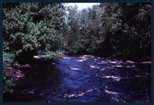
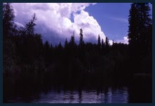

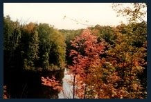
































1 comment:
The beautiful town of Blind River, Ontario is mentioned in the classic mystery set in the Upper Peninsula, "Blood is the Sky" by Steve Hamilton. More info here: http://authorstevehamilton.com
Oh, and listen to Neil Young's song "Long May You Run" for a tribute to Neil's days in Blind River. What can I say? There's something magic about Blind River!
See: Mississagi River canoe post from this same website.
Signed,
Bucky Beever
(a Blind River resident)
Post a Comment