

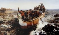
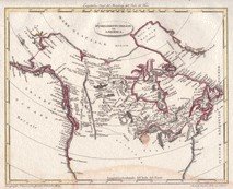
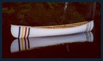
Albany River
May 20th-June 1st - 1983
May 20th-June 1st - 1983
(Kabinakagami, Kenogami & Albany to Fort Albany)
"What sets a canoeing expedition apart is that it purifies you more rapidly and inescapably than any other travel. Travel a thousand miles by train and you are a brute; pedal five hundred on a bicycle and you remain basically a bourgeois; paddle a hundred in a canoe and you are already a child of nature."
Pierre Elliot Trudeau
* * *
Brian and I clambered out of the Ontario Northland bus idling on the dusty shoulder of Hwy 17. The northern town of Hearst greeted us with the same greyness with which we departed Cochrane’s train station hours earlier. With our car deposited in wait of our return, we entered the roadside pub in eager anticipation of lunch and hopes of negotiating a ride back to our jump-off site. Scattered truckers punctuated the odd tables as most of the mid-day crowd had already departed to complete their day. A cheerful waitress delivered the usual pub fare as my quarter coaxed ‘BTO’s’ ‘Blue Moanin’ from the juke box. With a nudge of my elbow, Brian grabbed a couple of ‘Molsons’ and approached two locals chatting away at a corner table. Greetings were followed by our proposal. A few more beers and a few dollars secured the chauffeuring services of Remy & Pierre as we found our way back down the dusty logging roads to where we had stowed our canoe and gear at daybreak Struck again by that peculiar emotion, I watched as the tail lights of our drivers’ car were devoured by the distant dusty horizon.Silence…..
We were now committed completing our journey.
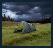
 Spurred on by approaching dusk, we retrieved our packs from the security of the dense bush and erected camp. Our fire drove away the cold dampness as we devoured supper and set to organizing our packs for tomorrow’s departure.
“Hello!” A greeting broke the silence. We stood and greeted a pair of native Indians who had followed the smoke of our fire to our camp. Welcoming our guests we learned that a small group of friends had come up for a day or two of fishing. A Canadian goose was roasting back at their camp but try as we might we couldn’t finagle an invitation to sample this northern fowl. With their departure we headed for the warmth of our sleeping bags and the anticipation of the journey ahead.
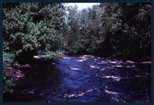
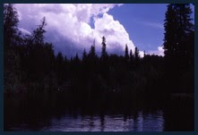
 The Kabinakagami River ran a murky brown as ice encrusted banks caressed it’s swift waters. The melting snows has swelled the river to frightening levels with the annual spring runoff. Skies remained a drab grey and the winds buffeted us as we pushed off, feeling the power of our river for the first time. The first paddle of the season is quick to ambush by means of blisters, aches and pains exposing winter stagnation. Fatigue came quickly as the fierce northerly gales howled menacingly in opposition to any progress we might make. Progress was so painfully slow we conceded to defeat and found a sheltered cove in which to pitch our tent.
 The inclement weather continued as the next day mirrored the first. We battled the weather, the river, our own physical pains and mental doubts in an attempt to preserve our schedule. Little headway could be achieved. We made for shore in hopes of finding some wind sheltered nook in which to prepare a quick lunch. Buffeting wind fought the flame of our camp stove and rattled our maps as Brian and I sat in silence, pondering our situation. Never before had we made such poor progress, with our destination looking so distant and out of reach. A sinking feeling in my stomach arose with the fleeting thought of having to be rescued from the river.
 We pushed on that afternoon in spite of the blowing snow pelting our faces. Our labouring breath clouded the cold air before us, our eyelashes lay heavy with snowflakes. A clearing with a cabin revealed itself on the western shore as we silently and simultaneously corrected our course for that shelter.
The moose hunter’s shack was in a sad state of repair as it lacked a door and the wind whistled through every un-chinked log in the structure. A rusty old drum stove sat one corner, its tin chimney ringing from falling pellets of ice. With the storm raging on the river, this collection of logs was nothing short of a suite at the Sheraton. The roof was sound but leaky so, for added shelter, we erected our tent on the dirt floor within . Gear was stowed, the stove cleaned and fired up, soggy clothes hung to dry and supper prepared. Trapped, yet safe, I crawled into the tent and immediately fell into a deep sleep.
 Gradually awakened to my surroundings I found myself staring at the nylon roof of my tent as my other senses slowly were coaxed to life. There was the pungent smell of wet pine in the chilled air as the sounds of the north wind continued to howl and buffet the loose CIL(1) plastic sheet that was our window pane. Nature was calling in more ways than one, forcing me out of the toasty warmth of my sleeping bag and into exploring the world outside the tarp covered door. Snow continued to blow horizontally as I groped along the cabin’s wall, stumbling over a collection of moose bones on my way to irrigate some convenient tree. A steamy retreat to the cabin followed and with the realization that we were weather bound for yet another day, another log was pushed into the stove. No recourse but to crawl back into the tent, granola bar and luke-warm coffee in hand. We drifted in and out of sleep all day, numbed by our situation and at mercy to the weather. The plastic window continued to flap. I will never forget the sound of that flapping plastic window!
 Dark and drab morning skies greeted us once again, yet the fallen snow had almost melted away with the rising temperature. We resumed our run down the river with a renewed sense of hope and as evening encroached on our afternoon light, we found ourselves at Mammamattawa. Mammamattawa is a Cree word for “where the rivers meet” - an appropriate name as here the Kabinakagami, the Kenogami, the Nagagami, the Ridge and Squirrel Rivers joined forces. Landing on the eastern shore, we hauled our gear up a steep bank to reach the clearing where three decrepit buildings stood leaning defiantly against the wind. As the ominous clouds raced overhead, a quick assessment of the site was made. We dared not venture into two of the buildings as they appeared moments from total collapse. Sadly, much of the wooden siding of the structures had been stripped away by previous travellers as an all too convenient source of firewood.
Once again we chose to erect our tent within the structure least likely to collapse upon us. Tarps were lashed to the windward walls, the camp stove lit and gear stowed - we called this collection of weather beaten boards “home”.
 After supper, Brian and I poked around the grounds, trying to roll back time and imagine what this site might have looked like in it’s heyday - bustling with activity - exploration, hunting and trade. Time will soon erase all traces of this outpost and sadly, it will probably not even warrant a footnote in any Canadian history books.
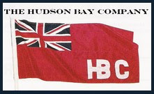
It was the North-West Company that originally chose this location in 1796 on which to build a fur trading post and it later went on to serve as a trading post for both the Hudson’s Bay Company and Revellon Frères Furriers of Paris which evolved into ‘Revlon’ cosmetics of today. It was hard to imagine that this outpost was in operation right up to 1946 as the relentless elements had all but obliterated the site in the four decades that preceded our trip.
The post was ideally situated in an area rich with both flora and fauna. Here we stood amongst white ash and black elm, neither of which is suppose to flourish north of the 50th parallel. Dutch elm disease had decimated elms further south. Plants included birch, spruce, aspen, dogwoods, trilliums, ostrich ferns and wild ginger. The land was rich with fur bearing animals including red, cross and silver fox, pine martin, ermine, timber wolf, beaver, otter, mink and muskrat.
 Hidden amongst the scattered debris was a piece of wood which obviously had been part of a crate. Brushing off the dust and grasses revealed the Hudson Bay Company logo. I was faced with a dilemma. The Canadian government had declared Mammamattawa a “sensitive site” which prohibited permanent habitation, the cutting of trees, alteration or removal of property. Impossible to enforce, the structures were quickly being scavenged for firewood. How this piece had escaped the flames, I do not know. Should I respect the decree and leave this historical artifact on site only to stoke some modern day voyager’s campfire or should I abscond with it, clean it and perhaps frame and preserve it? Reluctantly I propped it against our building’s wall and left it to whatever fate awaited it. How I now regret that decision…
 Our steamy breath announced the arrival of the cold night air and we set about securing the camp. Hauling our canoe up the steep bank to the clearing would be a daunting task. Instead we left it below, having lashed it to several tree stumps and thrown rocks on the lines for added security. With a turn of the knob the lantern extinguished and we crawled into our tent.
Howling winds awakened us around 3:00 am as it buffeted and snapped at the tent fly. A storm raging outside had us urgently fumbling about the tent grasping for a coat and searching for that missing boot, under the beam of an unsteady flashlight clenched between teeth. So violent was
 the storm that we couldn’t risk leaving our canoe at river level even with the added precautions we had taken hours earlier. Making our way to the bluff that overlooked the river we could barely make out the silhouette of the canoe rocking on the gravel below. I cautiously stepped over the ledge, feeling for some foothold only to find my boot shooting out from beneath me as I rode down the rest of the muddy bank on my behind. Brian didn‘t fare much better as we found ourselves lying crumpled at the bow of the canoe. The problem now was simple. If we didn’t want to sacrifice our canoe to the river gods, we had no choice but to haul it back up that slippery slope to higher ground.
After numerous attempts and even greater number of curse words the canoe arrived on the flat plain above the river. Not taking any chances, we secured the bow to a stump once again. The pelting rain was beginning to wash the mud off our clothes as we dripped our way back to the shelter of our building. Filthy, we removed what clothing we could and crawled back into our tent to continue a fitful sleep.
Was the sun ever going to show itself on this trip? Every moment was now precious if we were to recover our schedule so we packed up and shoved off on this blustery morning.

 It was hard slugging but a sense of urgency coaxed us along. Even with a strong headwind, we made good progress that day, paddling dawn till dusk. Exhausted, we created another campsite by beating our way back into the bush. We had a real sense of accomplishment for the first time in our wind bound journey. The trees here were mostly saplings - new growth from a previous forest fire perhaps? We sat around our fire, sheltered from the winds, and in spite of our fatigue, chatted long into the night.
The inclement weather had finally broken and we had several typical crisp, beautiful spring days in which to reclaim lost time.
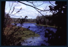
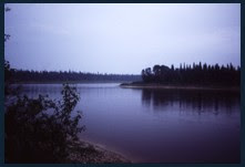
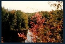
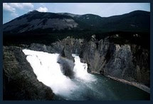
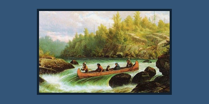
 The Albany river was typical of the northern Ontario rivers which flow from the Canadian Shield onto the Hudson Bay lowlands. On our stretch of the Albany, the transition had already occurred and was not as dramatic as on the Missinaibi where it was delineated by Thunderhouse Falls. The river was confined by riverbanks of varying heights but usually we had some climbing to do to find a suitable piece of flat real estate suitable for our tent. Trees growing too close to the riverbank had their boughs trimmed yearly by the ice floes during the spring break-up. Venturing inland, the trees quickly gave way to bogs and swamps. This is no place to be lost! On these wilderness rivers there are no marked campsites as voyagers are still infrequent.
 On some rivers, abandoned historical sites such as Mammamattawa might provided refuge for a night. On the Albany as with the Missinaibi, remote environmental monitoring stations may offer sanctuary. We consider ourselves lucky if we find a sheltered outcrop and not have to beat our way into the virgin bush.
For the first half of our trip the banks were encrusted with turquoise-white blocks of ice, heaved into towering walls from the spring break-up. Vigilance was of utmost importance when canoeing near these frozen banks as huge chunks would break off without warning and splash into the river below.
 The resulting waves could rock, if not sink the unprepared canoeist. Caution was of equal importance when landing as sound footing was always a concern as was securing the canoe and finding solid ground.
Several days of paddling brought us to a point marked ‘Ghost River’ on our topographical maps. Pulling to shore we brought out our lunch packs and were able to stretch out and bask in the warmth of the sun for the first time in our voyage. This site had been cleared at some time in the past although grasses and shrubs were attempting to reclaim the land. Had this been some past outpost, a settlement, a
 homestead? Evidence of permanent habitation revealed itself with the presence of several grave sites. I wondered who had lived and who had died here - under what circumstances? The graves had stone markers and were framed by weathered picket fences that showed the ravages of Albany winters. Yet someone cared. Draped over a fencepost was a rosary and artificial flowers, recently faded by the northern sun. Someone cared enough to make a pilgrimage to this rather remote location, so I too cleared fallen debris off of the grave, straightened the fence and offered up a prayer.
 No permanent structures were found other than a pole and bark tee-pee. Peeking indoors, the only signs of habitation were one gum-rubber boot and a broken transistor radio. An additional roof over our heads if we found ourselves stormbound but as the weather was ideal for traveling we forged ahead. Brian and I spent mornings examining topographical maps in an attempt to determine which riverbank would offer the safest route and most sheltered passage. Regardless, we found ourselves in the middle of the mile wide Albany when surprised by a sudden increase in the winds. In this precarious position, our best course of action was to pull for the shelter of the north western shore. Straining against the wind with each stroke of the paddle, we made little headway as waves broke over our bow. Frenzied paddling eventually did bring us to safely to shore where we collapsed in exhaustion. Wind bound, we were committed to camp at this site, chosen not by us but rather the weather. We glanced up and noticed our six foot slip of land ended at the base of a earthen cliff towering some sixty feet above us. The landing itself offered no shelter so we were obligated to climb the cliff, foot by foot, carrying only our most essential gear. Brute force again beat the campsite out of the bush where I had no doubt that humans had never set foot before. The view was spectacular but my interest was always diverted to checking on the canoe far below.
 Morning once more found us on the river. With our schedule met, we could leisurely glide down the Albany as it widened and began to form the channels of it’s delta. Our final camp was on a treeless expanse on the eastern bank. We stopped at midday and indulged in a banquet. Not only did we have a tremendous appetite but with Fort Albany in reach, a lighter load was essential for our flight out. Peanut butter on crackers, cans and cans of flaked ham, GORP (2) , and the last of the smoke cured bacon. The sun was now beating down, showering us with it’s warmth. With gear scattered all about we laid down a tarp drifted off to pleasant afternoon nap. I recall waking periodically and seeing the sun sparkle through my eyelashes while beads of perspiration gathered on my forehead. Grasses and rushes swayed gently in the breeze as the reassuring sound of running water gurgled nearby. This is what life is about! As the sun descended, we shook off our lethargy and arranged camp. In preparation of whatever “civilization” we might find at Fort Albany, we decided that a bath was in order. The icy spring runoff was continuously filling pools surrounding our camp as the rivulets joined in search of the river. Undressing we grit our teeth and climbed into a nearby basin. Shivering, we soaped up and shampooed as swiftly as possible. With a quick dunking, I emerged from the frigid waters blue as a smurf . Clean and refreshed but with clattering teeth!
Brian and I pulled out our topographical map and examined the Albany River delta which would be upon us tomorrow. This was before the days of GPS (3) so it was crucial that we negotiate our route correctly. Stories abound of people being lost for days after taking the wrong channel in the delta. I had failed to get a satellite photo of the delta and James Bay from the Canadian Center For Remote Sensing. I had hoped that a current photo would reveal any changes in the delta not reflected in the map as well as revealing the condition of James Bay if we chose to canoe the waters from Fort Albany to Moosonee. With navigational decisions made and gear repacked for what should be the final time, we turned in.
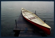
Our final day on the river was once again pleasant as the current carried us closer to Fort Albany. Periodic course corrections were made after consulting our maps. Shallow rapids and riffles were run with ease under the warmth of the sun. A communication tower appeared on the right affirming that civilization was within reach. We discovered that we too had become victims of the Albany river delta. Even with all our planning we had taken an unintended channel, however the resulting error had actually taken us closer to our destination of the airport. With less overland distance to haul our canoe across, the error was only a blow to my navigational ego and not to my back. We pulled the old Grumman ashore for the final time as we had decided not to attempt the hazardous trip on James Bay. Scouting the location, Brian and I determined that the main town lay to the left, the airport to the right, joined by a road which was partially submerged during high tide.

I had a chuckle as some natives greeted us. They lifted the bow of our canoe and shook their heads, wondering why anyone would chose to expend energy hauling gear manually in the era of motor boats. We were informed that we were the first to reach Fort Albany by canoe that year. Securing our gear, Brian and I set off to explore town. The center of the settlement was marked by the Anglican church. Prefab homes in various states of repair lined the gravel streets, typical of these northern towns. A tar-paper covered general store appeared to be closed for the day.
 Near the airport stood some government offices and the James Bay Regional Hospital. Anxious to make arrangements for our flight out, we walked back to the airport and entered the shack that served as the airport terminal. A lone native gentleman served as booking agent, an old scale indicated the baggage department and a couple of rickety chairs served as the departure waiting lounge. We hadn’t made reservations for the flight out as we couldn’t guarantee our date of arrival nor had we decided on the possibility of canoeing the bay. The weathered fellow behind the ticket counter shocked us with the information that they really couldn’t accommodate us, our gear and canoe, until much later in the week! He suggested we make camp and wander over to the hospital’s nursing residence. A dance was being held that night and new faces would be welcomed. Lonely nurses? Hmmmm, tempting. However my dancing boots were mud caked so we chose to pass. Not prepared to spend that much more time in town, we appealed to the fellow if some solution couldn’t be found. Calling ahead on the radio, he spoke with the pilot who was still in Attapawiskat. If we would be prepared, we might be able to get out on the next flight when it arrived in a few hours.
 We once again repacked, discarding unnecessary gear and provisions. I handed bars of chocolate to the delight of native children that had gathered around us with their bicycles. Stripped down to the bare minimum we crossed our fingers and awaited the arrival of our plane.
A gentle drone was heard to the north as the Austin Airways Hawker-Sidley twin engine plane approached the strip at Fort Albany. This workhorse of the north landed in a cloud of dust and a flurry of activity began even before it rolled to a halt. The engines remained running as doors opened to passengers and baggage. When those deplaning had cleared the area, we found ourselves waved ahead with instructions to hand our gear and canoe to crew members aboard. We watched as our 17 foot Grumman was swallowed up by the closing door. It fit! Boarding through the rear we stood in shock as the crew had moved passengers to seats further back and our canoe sat wedged between seats in the passenger alley while protruding into the cockpit. Numerous aviation safety regulations must have been broken that day but such is life on the northern frontier. The passengers were comprised of natives, government agents and workers for various exploration firms. Their curiosity aroused, we had become instant celebrities and had to regale them with our river tale.

It was sobering to look out the aircraft window and see the expanse of channels and continuous bogs that comprised the Albany River delta. One did not have to venture far from town to experience the rugged, unforgiving desolation of the landscape. To my left I was surprised to see that James Bay was still quite frozen over and had we chosen to canoe to Moosonee, we would have been sledging the canoe by foot over the ice packs. Far too hazardous if at all possible at this time of year.


It was a short flight to the town of Moosonee which was quite familiar to us from previous trips. We would hold up at the ‘Polar Bear Lodge’ until we could catch the Ontario Northland Railway’s ‘Northlander' for the eight hour trip back to Cochrane where our car lay in wait of our return.
 Moosonee & One Channel of Moose River From The Air
_____________________________________________________
(Including Flight To Moosonee)
© Copyright - All rights reserved.
Google Earth Co-ordinates:
(cut and paste everything after the dash- (in red) into Google Earth search bar.
(cut and paste everything after the dash- (in red) into Google Earth search bar.
Kabinakagami River Jump-off Location
Lat/Long- 50° 05’14.62” N, 84° 09’36.92” W
Mammamattawa (Hudson Bay Co. Post - abandoned)
Lat/Long- 50° 24’53.40” N, 84° 22’31.34” W
Ghost River
Lat/Long- 51° 28’37.76” N, 83° 24’ 18.03” W
Ft Albany (Airport)
Lat/Long- 52° 12’30.72” N, 81° 41’13.28” W
Lat/Long- 50° 05’14.62” N, 84° 09’36.92” W
Mammamattawa (Hudson Bay Co. Post - abandoned)
Lat/Long- 50° 24’53.40” N, 84° 22’31.34” W
Ghost River
Lat/Long- 51° 28’37.76” N, 83° 24’ 18.03” W
Ft Albany (Airport)
Lat/Long- 52° 12’30.72” N, 81° 41’13.28” W
Albany River Top Maps (used on our trip)
42 K/1 -Limestone Rapids (1:50,000)
42 K/8 - Mammamattawa (1:50,000)
42 K/9 -Pitukupi Lake (1:50,000)
42 K/16 -Wakashi/Kenogami River (1:50,000)
42 K/15 -Little Drowning River (1:50,000)
42 K -Kenogami River (1:250,000)
42 N -Ogoki (1:250,000)
42 O -Ghost River (1:250,000)
43 B -Kapskau River (1:250,000)
43 A - Fort Albany (1:250,000)
The topographical maps used on our 1983 trip were a mix of 1:50,000 and 1:250,000 scale maps depending on which were published & available at that time. Most of the maps were only available as monochrome (black on white). Our preference was to obtain the 1:50,000 when available as they showed more detail in landmarks allowing for increased accuracy in calculating distance traveled and better anticipation of possible future campsites.
Federal Publications (Toronto, ON) is one of numerous distributors of maps and I have included a link to their Map Home Page and the Northern Ontario section which includes both the Albany & Missinaibi Rivers. The link here is not an endorsement of their site, however it did offer a neat, quick and easy to navigate site to the maps required for these trips. On their site, clicking on any map sector will bring you to the details of that map as well as instructions for purchasing the maps.
Federal Maps (Northern Ontario)
Federal Maps - Home Page (Maps)
An alternative source of top maps is the Canada Map Office
42 K/1 -Limestone Rapids (1:50,000)
42 K/8 - Mammamattawa (1:50,000)
42 K/9 -Pitukupi Lake (1:50,000)
42 K/16 -Wakashi/Kenogami River (1:50,000)
42 K/15 -Little Drowning River (1:50,000)
42 K -Kenogami River (1:250,000)
42 N -Ogoki (1:250,000)
42 O -Ghost River (1:250,000)
43 B -Kapskau River (1:250,000)
43 A - Fort Albany (1:250,000)
The topographical maps used on our 1983 trip were a mix of 1:50,000 and 1:250,000 scale maps depending on which were published & available at that time. Most of the maps were only available as monochrome (black on white). Our preference was to obtain the 1:50,000 when available as they showed more detail in landmarks allowing for increased accuracy in calculating distance traveled and better anticipation of possible future campsites.

Federal Publications (Toronto, ON) is one of numerous distributors of maps and I have included a link to their Map Home Page and the Northern Ontario section which includes both the Albany & Missinaibi Rivers. The link here is not an endorsement of their site, however it did offer a neat, quick and easy to navigate site to the maps required for these trips. On their site, clicking on any map sector will bring you to the details of that map as well as instructions for purchasing the maps.
Federal Maps (Northern Ontario)
Federal Maps - Home Page (Maps)
An alternative source of top maps is the Canada Map Office
* * *
 (Click On Map To Enlarge)
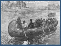
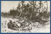
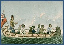
 Fort Albany - 1886

(1) CIL: Canadian Industries Limited - A manufacturer of various products from chemicals, fertilizers, paints and plastics amongst others. Our Window had the faded oval CIL logo stamped on it. (Click On Map To Enlarge)
 Fort Albany - 1886
(2) GORP: Good Old Raisins and Peanuts and now also referring to ‘Trail Mix’ which may also include dried fruits and various seeds.
(3) GPS: Global Positioning Satellite/System - geosynchronous orbiting satellites through a form of triangulation, inform the modern day traveler of his/her position on earth within a few metres of error.
New (August 2010) - I've added the original Ministry of Natural Resources (MNR) Route description that we used on the 1982 trip, including a MNR hand drawn map in a separate post entitled: Suppememental River Trip Descriptions
 Addendum:
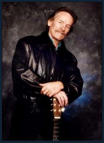
On July 2nd 1983, having completed canoeing Ontario’s Albany River, I was oblivious to what world events had transpired during my ten days of river travel. Relative isolation continued during the next nine hours as our train made it’s way south through the wilds of Ontario’s boreal forests. Early evening found us deposited amidst a flurry of activity at Cochrane’s railway station where we packed our car and headed south in search of lodging. It wasn’t until the next day’s drive south that I dared to ease myself into civilization by braving the politics, talk radio and the odd Michael Jackson tune that would blare from the car radio. A quick headline amongst the chatter had me grasp the steering wheel and sit upright with attention. “A prominent Canadian folk artist has been killed in an airline tragedy- Stay tuned for the news….”
No! Not Gordon Lightfoot!!! Please!!!…..
At the top of the hour the newscaster elaborated that on July 2nd, a fire aboard an Air Canada flight in Cincinnati Ohio had claimed the life of Stan Rogers.
I was no less devastated!!!
 Stan was enormously talented individual with a booming baritone voice, a love for his maritime roots and an uncanny ability to weave a few words into colourful stories that grab you by the soul and tug at your heart. Still disbelieving, Stan’s cassettes were rotated through the player for the remainder of our journey. Stan’s death and music has, in my mind, become inextricably linked to that sombre drive south so long ago. For those unfamiliar with Stan Roger’s music, I suggest you treat yourself by listening to any one of his eight albums. You too will find yourself captivated by his magic. This post is for you Stan….


13 comments:
hey hello there im from fort albany i seee youer pic's there nice old pic's
I just paddled the Albany River this summer start to finish and it was great seeing your portion of the Albany’s pictures. Amazing how twenty five years later the river looks nearly the same as those pictures. I remember seeing on the Topo ghost river and being curious but there was nothing there (the water was very high this year maybe it was underwater or maybe we just missed it.) The last night you said you spent on the river there’s a picture of it on a gravel bar near shore. I stayed in the same spot on my last night im sure of it (firewood was a challenge) and so was navigating which was my responsibility that particular day. Fort Albany sounds unchanged the airport and all. Thank you for your stories and pictures.
Patrick
Hey Patrick
I'm paddling the Albany from Lake St.Jo to the Bay this summer and would appreciate a conversation. This is the first time I have left a comment online so I'm not sure how this works.
Ty
Sorry Ty,
Patrick was just an 'anonymous' visitor to my blog and left his comment about his own Albany River trip. I have no idea who he is or how to reach him. As he visited this site a half year ago, I doubt he will be checking back, otherwise you could leave your e-mail and he could write to directly.
Sounds like a fantastic trip you have lined up for this summer - I'm envious!
Good Luck!
Yuri
Thanks Yuri for the great information and maps...I am taking a class of 10 students down the Albany along the same route as yours on June 4, 2010. I am looking forward to returning to Fort Albany where I began my teaching career in 1998.
JP in Moosonee
JP, in case you check back, good luck on your trip. Plan carefully for with 10 students, finding large and accessible campsites might be challenging. Mammammattawa, and Ghost River are certainly large and clear enough. Most of all, stay safe and drop another post when you're finished.
Yuri
Hello all. My name is Stephen James the albany river has been on my list for a while now, I plan to paddle it perhaps next year or the year after. However im also an (aspiring) film maker and Im working on a film that would take place on the Albany River, I was wondering if any of the people here would be able to provide me with some pictures, stories, or description of interesting places on the river that could make for interesting highlights in the film. At this point I still have zero budget so I cant promis any monetary compensation but you would of couse receive a credit in the final film (assuming im successful in producing it)
I can be reached at stephenjames1515@gmail.com
thanks vary much in advance
Myself and 3 close friends are planning on canoeing the Albany River from Lake St. Joseph in July 2012! I would love to dicuss any tips or information that anyone is willing to share.
I can be reached at:
wendywyner4@hotmail.com
Thanks
April
thanks for the story and pics yuri. i paddled the river as a camper with camp kandalore in summer 1984 from Lake St Joe (we were bussed in) to fort albany (flew out as you did). unf no pics - nothing. so it was nice to see yours.
certainly once we got out of the Sheild and into the Lowlands - we camped alot on sand bars on the river. perhaps the water was low at the time (we were mid july - mid aug). this had the benefit of being relatively bug free and there was plenty of dry driftwood for the fire.
marvellous times.
Hi Yuri.....really enjoyed your blog..a lot of work.
I just started one maybe you could add something
www.dumoinewatershed.blogspot.com
Nice post Yuri.
I paddled the Albany solo back in the early 80s, from the Vermillion River/Lac St. Joseph direction--3 weeks alone.
It was just as you described. I spoke with Bob Davis, a Canuk paddler who returned to mooseonee along the coast, describing it as some of the worst nights he ever spent in the bush. I almost did it myself, but the natives were adamant. Four canoers had disappeared there a year previous to my visit. You can't really get lost in the delta--it was one of the best memories of my life waking up on a gravel bar to the low murmurs of a flock of sandhill cranes.
hi Yuri
as this is so far the only blog post i have found of the lower Albany. There are starting plans to do a similar trip to this area in Spring 2021
Is there any guide/ points you can forward.
I realize a lot is changed in almost 40 years.
but i'm just starting to do my research here.
Greetings
Emmy
We did this trip in 2022 with one canoe and two people.
Put-in: We put in about 10km downstream from Limestone Rapids. There is a public boat launch here that may not have existed when Yuri took the trip. Take road 663 going north from highway 11. Instead of going thru the first nations community, circle to the left around the large sawmill. Turn left before you see the sawmill. You’ll circle back around to a north-south road just north of the first nations community. This gravel road ends at the river. Google Maps might be helpful.
Take-out: Just keep the mainland on your right, and you’ll be fine. Ft. Albany is on the south-east corner of Sullivan Island. On the topo map, it looks like you might be able to take the south channel around the island, but the channel is blocked at the Albany with an earthen dam and there isn’t much water. If you just keep the mainland on your right and take the north channel, you won’t have any issues with the delta. After going under some powerlines, you’ll get to the north-east corner of the island, turn right (south). Paddle down the east channel until you hit an earthen dam and a boat launch. You can see the airport from the top of the dam, which is also a road.
Rapids/Portages: We paddled in late July, but everyone told us the water was up. We had nothing to portage. At lower water there may have been a few places where you would need to drag your boat. The rapids on Yuri’s old MNR map are class 1 and easily run. There is no white water to speak of on this run.
Camping: Campsites are an issue. There are no designated campsites and there aren’t those ‘traditional’ spots you see when padding in the Canadian shield. Because you are in the Hudson Bay Lowlands, the river is a channel thru the clay soil. There are 10’ to 100’ high mud banks on either side. The ground slopes upward from the river to the base on the ‘cliffs’. The best camping is where there is a lot of gravel/pebbles/rock in the area between the river and the mud bank. If there is not a lot of stone, then the ground is either mud or swamp. We pitched our tent on the rocks where we could find a somewhat level spot, the tent always seemed to be sloped toward the river. Finding tent sites for a large group would be a challenge. You could try the woods and the bugs, but even the lesser mud banks can be a challenge, as we discovered when collecting wood.
Fishing: Fish where the creeks enter the river. We had limited success, but we aren’t big fishermen. We caught walleye and pike, but were told there are trout.
Travel time: We easily did the trip in 12 days, even with a wasted day paddling upstream to retrieve a forgotten camera. By the time we got to the Albany, we were paddling 4 to 5 mph. It has a pretty good current.
dheym@wowway.com
Post a Comment